You are here: Home > Network List > AZ - ANZA Regional Network Stations List
> Station LVA2 AZ.LVA2 > Earthquake Result Viewer
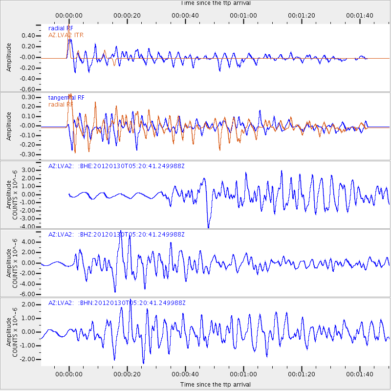
LVA2 AZ.LVA2 - Earthquake Result Viewer

| Earthquake location: |
Near Coast Of Peru |
| Earthquake latitude/longitude: |
-14.2/-75.6 |
| Earthquake time(UTC): |
2012/01/30 (030) 05:11:00 GMT |
| Earthquake Depth: |
43 km |
| Earthquake Magnitude: |
6.3 MB, 5.9 MS, 6.4 MW, 6.4 MW |
| Earthquake Catalog/Contributor: |
WHDF/NEIC |
|
| Network: |
AZ ANZA Regional Network |
| Station: |
LVA2 AZ.LVA2 |
| Lat/Lon: |
33.35 N/116.56 W |
| Elevation: |
1435 m |
|
| Distance: |
61.3 deg |
| Az: |
321.307 deg |
| Baz: |
133.576 deg |
| Ray Param: |
0.060879536 |
| Estimated Moho Depth: |
36.0 km |
| Estimated Crust Vp/Vs: |
1.96 |
| Assumed Crust Vp: |
6.264 km/s |
| Estimated Crust Vs: |
3.196 km/s |
| Estimated Crust Poisson's Ratio: |
0.32 |
|
| Radial Match: |
89.891685 % |
| Radial Bump: |
391 |
| Transverse Match: |
88.212875 % |
| Transverse Bump: |
400 |
| SOD ConfigId: |
436445 |
| Insert Time: |
2012-04-11 04:33:32.003 +0000 |
| GWidth: |
2.5 |
| Max Bumps: |
400 |
| Tol: |
0.001 |
|
Signal To Noise
| Channel | StoN | STA | LTA |
| AZ:LVA2: :BHZ:20120130T05:20:41.249988Z | 7.725171 | 1.1847991E-6 | 1.5336866E-7 |
| AZ:LVA2: :BHN:20120130T05:20:41.249988Z | 1.2289803 | 2.4993327E-7 | 2.0336638E-7 |
| AZ:LVA2: :BHE:20120130T05:20:41.249988Z | 1.5423324 | 3.7592136E-7 | 2.4373563E-7 |
| Arrivals |
| Ps | 5.7 SECOND |
| PpPs | 16 SECOND |
| PsPs/PpSs | 22 SECOND |


