You are here: Home > Network List > KN - Kyrgyz Seismic Telemetry Network Stations List
> Station CHM KN.CHM > Earthquake Result Viewer
CHM KN.CHM - Earthquake Result Viewer
*The percent match for this event was below the threshold and hence no stack was calculated.
| Earthquake location: |
Philippine Islands Region |
| Earthquake latitude/longitude: |
17.4/119.9 |
| Earthquake time(UTC): |
2014/04/21 (111) 20:45:22 GMT |
| Earthquake Depth: |
11 km |
| Earthquake Magnitude: |
5.5 MWB |
| Earthquake Catalog/Contributor: |
NEIC PDE/NEIC COMCAT |
|
| Network: |
KN Kyrgyz Seismic Telemetry Network |
| Station: |
CHM KN.CHM |
| Lat/Lon: |
43.00 N/74.75 E |
| Elevation: |
655 m |
|
| Distance: |
45.9 deg |
| Az: |
313.561 deg |
| Baz: |
109.459 deg |
| Ray Param: |
$rayparam |
*The percent match for this event was below the threshold and hence was not used in the summary stack. |
|
| Radial Match: |
66.19798 % |
| Radial Bump: |
379 |
| Transverse Match: |
34.76394 % |
| Transverse Bump: |
400 |
| SOD ConfigId: |
3390531 |
| Insert Time: |
2019-04-11 14:03:53.587 +0000 |
| GWidth: |
2.5 |
| Max Bumps: |
400 |
| Tol: |
0.001 |
|
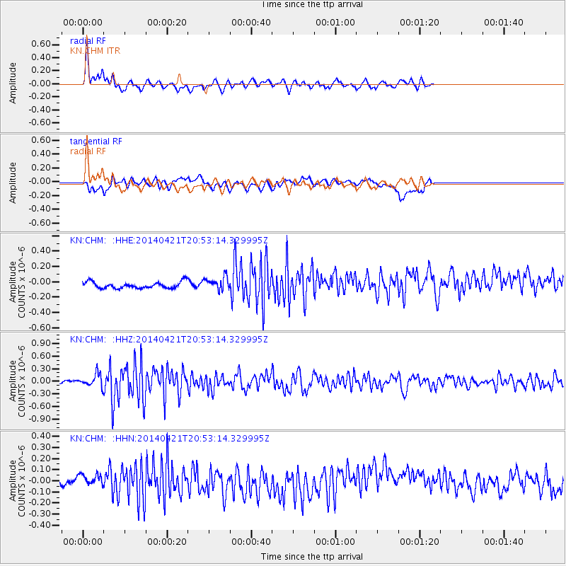
Signal To Noise
| Channel | StoN | STA | LTA |
| KN:CHM: :HHZ:20140421T20:53:14.329995Z | 3.2087193 | 1.5431714E-7 | 4.8093064E-8 |
| KN:CHM: :HHN:20140421T20:53:14.329995Z | 1.5937198 | 6.5890745E-8 | 4.1343995E-8 |
| KN:CHM: :HHE:20140421T20:53:14.329995Z | 2.217552 | 7.9977085E-8 | 3.6065487E-8 |
| Arrivals |
| Ps | |
| PpPs | |
| PsPs/PpSs | |


