BFS Mt Baldy Forest Station - Earthquake Result Viewer
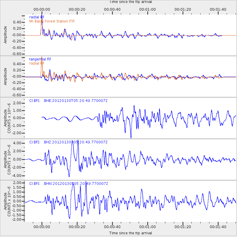
Earthquake location: Near Coast Of Peru
Earthquake latitude/longitude: -14.2/-75.6
Earthquake time(UTC): 2012/01/30 (030) 05:11:00 GMT
Earthquake Depth: 43 km
Earthquake Magnitude: 6.3 MB, 5.9 MS, 6.4 MW, 6.4 MW
Earthquake Catalog/Contributor: WHDF/NEIC
Network: CI Caltech Regional Seismic Network
Station: BFS Mt Baldy Forest Station
Lat/Lon: 34.24 N/117.66 W
Elevation: 1312 m
Distance: 62.6 deg
Az: 321.328 deg
Baz: 132.979 deg
Ray Param: 0.060056567
Estimated Moho Depth: 10.5 km
Estimated Crust Vp/Vs: 1.75
Assumed Crust Vp: 6.276 km/s
Estimated Crust Vs: 3.596 km/s
Estimated Crust Poisson's Ratio: 0.26
Radial Match: 89.84693 %
Radial Bump: 400
Transverse Match: 88.41185 %
Transverse Bump: 400
SOD ConfigId: 436445
Insert Time: 2012-04-11 04:41:05.972 +0000
GWidth: 2.5
Max Bumps: 400
Tol: 0.001

Signal To Noise

ChannelStoNSTALTA
CI:BFS: :BHZ:20120130T05:20:49.770007Z7.41993869.573355E-71.2902201E-7
CI:BFS: :BHN:20120130T05:20:49.770007Z2.48997642.7956028E-71.12274265E-7
CI:BFS: :BHE:20120130T05:20:49.770007Z2.88743544.884245E-71.6915513E-7
Arrivals
Ps1.3 SECOND
PpPs4.4 SECOND
PsPs/PpSs5.7 SECOND