You are here: Home > Network List > IW - Intermountain West Stations List
> Station DLMT Dillon, Montana, USA > Earthquake Result Viewer
DLMT Dillon, Montana, USA - Earthquake Result Viewer
*The percent match for this event was below the threshold and hence no stack was calculated.
| Earthquake location: |
Near Coast Of Peru |
| Earthquake latitude/longitude: |
-14.2/-75.6 |
| Earthquake time(UTC): |
2012/01/30 (030) 05:11:00 GMT |
| Earthquake Depth: |
43 km |
| Earthquake Magnitude: |
6.3 MB, 5.9 MS, 6.4 MW, 6.4 MW |
| Earthquake Catalog/Contributor: |
WHDF/NEIC |
|
| Network: |
IW Intermountain West |
| Station: |
DLMT Dillon, Montana, USA |
| Lat/Lon: |
45.36 N/112.60 W |
| Elevation: |
1569 m |
|
| Distance: |
68.0 deg |
| Az: |
332.803 deg |
| Baz: |
141.036 deg |
| Ray Param: |
$rayparam |
*The percent match for this event was below the threshold and hence was not used in the summary stack. |
|
| Radial Match: |
79.626 % |
| Radial Bump: |
400 |
| Transverse Match: |
69.54405 % |
| Transverse Bump: |
400 |
| SOD ConfigId: |
436445 |
| Insert Time: |
2012-04-11 04:50:42.151 +0000 |
| GWidth: |
2.5 |
| Max Bumps: |
400 |
| Tol: |
0.001 |
|
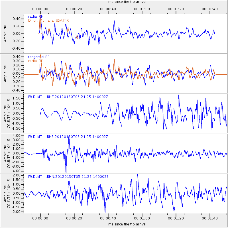
Signal To Noise
| Channel | StoN | STA | LTA |
| IW:DLMT: :BHZ:20120130T05:21:25.140002Z | 4.0633926 | 5.9746793E-7 | 1.4703672E-7 |
| IW:DLMT: :BHN:20120130T05:21:25.140002Z | 0.9744013 | 1.8476922E-7 | 1.8962332E-7 |
| IW:DLMT: :BHE:20120130T05:21:25.140002Z | 0.6452321 | 1.9225256E-7 | 2.9795876E-7 |
| Arrivals |
| Ps | |
| PpPs | |
| PsPs/PpSs | |


