You are here: Home > Network List > TA - USArray Transportable Network (new EarthScope stations) Stations List
> Station D32A Dogwood Acres, Gardner, ND, USA > Earthquake Result Viewer
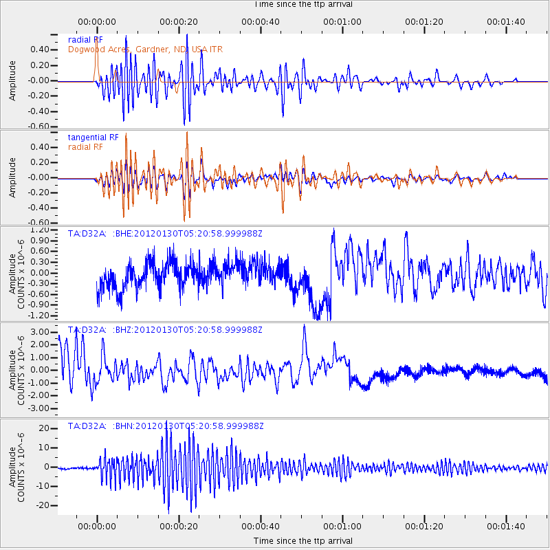
D32A Dogwood Acres, Gardner, ND, USA - Earthquake Result Viewer
*The percent match for this event was below the threshold and hence no stack was calculated.
| Earthquake location: |
Near Coast Of Peru |
| Earthquake latitude/longitude: |
-14.2/-75.6 |
| Earthquake time(UTC): |
2012/01/30 (030) 05:11:00 GMT |
| Earthquake Depth: |
43 km |
| Earthquake Magnitude: |
6.3 MB, 5.9 MS, 6.4 MW, 6.4 MW |
| Earthquake Catalog/Contributor: |
WHDF/NEIC |
|
| Network: |
TA USArray Transportable Network (new EarthScope stations) |
| Station: |
D32A Dogwood Acres, Gardner, ND, USA |
| Lat/Lon: |
47.14 N/97.02 W |
| Elevation: |
280 m |
|
| Distance: |
64.0 deg |
| Az: |
343.918 deg |
| Baz: |
156.824 deg |
| Ray Param: |
$rayparam |
*The percent match for this event was below the threshold and hence was not used in the summary stack. |
|
| Radial Match: |
31.7259 % |
| Radial Bump: |
400 |
| Transverse Match: |
39.567844 % |
| Transverse Bump: |
400 |
| SOD ConfigId: |
436445 |
| Insert Time: |
2012-04-11 05:15:11.711 +0000 |
| GWidth: |
2.5 |
| Max Bumps: |
400 |
| Tol: |
0.001 |
|
Signal To Noise
| Channel | StoN | STA | LTA |
| TA:D32A: :BHZ:20120130T05:20:58.999988Z | 0.7814538 | 1.1033085E-6 | 1.4118665E-6 |
| TA:D32A: :BHN:20120130T05:20:58.999988Z | 11.360474 | 4.792726E-6 | 4.2187733E-7 |
| TA:D32A: :BHE:20120130T05:20:58.999988Z | 0.9004193 | 3.2206117E-7 | 3.576791E-7 |
| Arrivals |
| Ps | |
| PpPs | |
| PsPs/PpSs | |


