You are here: Home > Network List > G - GEOSCOPE Stations List
> Station HYB Hyderabad, India > Earthquake Result Viewer
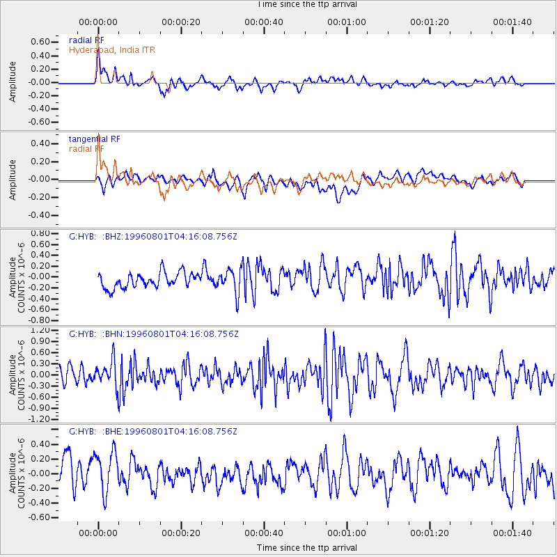
HYB Hyderabad, India - Earthquake Result Viewer
*The percent match for this event was below the threshold and hence no stack was calculated.
| Earthquake location: |
Minahassa Peninsula, Sulawesi |
| Earthquake latitude/longitude: |
-0.0/122.9 |
| Earthquake time(UTC): |
1996/08/01 (214) 04:08:23 GMT |
| Earthquake Depth: |
149 km |
| Earthquake Magnitude: |
5.5 MB, 5.6 UNKNOWN, 5.5 MW |
| Earthquake Catalog/Contributor: |
WHDF/NEIC |
|
| Network: |
G GEOSCOPE |
| Station: |
HYB Hyderabad, India |
| Lat/Lon: |
17.42 N/78.55 E |
| Elevation: |
510 m |
|
| Distance: |
47.0 deg |
| Az: |
294.027 deg |
| Baz: |
106.929 deg |
| Ray Param: |
$rayparam |
*The percent match for this event was below the threshold and hence was not used in the summary stack. |
|
| Radial Match: |
66.74534 % |
| Radial Bump: |
400 |
| Transverse Match: |
50.891438 % |
| Transverse Bump: |
400 |
| SOD ConfigId: |
4480 |
| Insert Time: |
2010-02-26 23:06:18.422 +0000 |
| GWidth: |
2.5 |
| Max Bumps: |
400 |
| Tol: |
0.001 |
|
Signal To Noise
| Channel | StoN | STA | LTA |
| G:HYB: :BHN:19960801T04:16:08.756Z | 1.782921 | 3.5956097E-7 | 2.0166962E-7 |
| G:HYB: :BHE:19960801T04:16:08.756Z | 1.6059676 | 2.9713595E-7 | 1.8501989E-7 |
| G:HYB: :BHZ:19960801T04:16:08.756Z | 1.695618 | 2.3146781E-7 | 1.3650941E-7 |
| Arrivals |
| Ps | |
| PpPs | |
| PsPs/PpSs | |


