You are here: Home > Network List > G - GEOSCOPE Stations List
> Station HYB Hyderabad, India > Earthquake Result Viewer
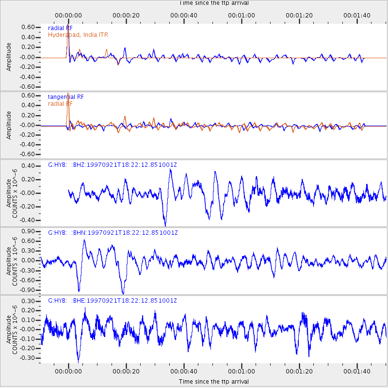
HYB Hyderabad, India - Earthquake Result Viewer
*The percent match for this event was below the threshold and hence no stack was calculated.
| Earthquake location: |
Lake Tanganyika Region |
| Earthquake latitude/longitude: |
-7.4/30.4 |
| Earthquake time(UTC): |
1997/09/21 (264) 18:13:22 GMT |
| Earthquake Depth: |
10 km |
| Earthquake Magnitude: |
5.7 MB, 6.2 MS, 6.0 UNKNOWN, 5.9 MW |
| Earthquake Catalog/Contributor: |
WHDF/NEIC |
|
| Network: |
G GEOSCOPE |
| Station: |
HYB Hyderabad, India |
| Lat/Lon: |
17.42 N/78.55 E |
| Elevation: |
510 m |
|
| Distance: |
53.6 deg |
| Az: |
62.141 deg |
| Baz: |
246.708 deg |
| Ray Param: |
$rayparam |
*The percent match for this event was below the threshold and hence was not used in the summary stack. |
|
| Radial Match: |
78.72655 % |
| Radial Bump: |
400 |
| Transverse Match: |
63.321743 % |
| Transverse Bump: |
400 |
| SOD ConfigId: |
4480 |
| Insert Time: |
2010-02-26 23:06:24.958 +0000 |
| GWidth: |
2.5 |
| Max Bumps: |
400 |
| Tol: |
0.001 |
|
Signal To Noise
| Channel | StoN | STA | LTA |
| G:HYB: :BHN:19970921T18:22:12.851001Z | 3.4452236 | 3.4496836E-7 | 1.00129455E-7 |
| G:HYB: :BHE:19970921T18:22:12.851001Z | 1.8134248 | 1.3973701E-7 | 7.705697E-8 |
| G:HYB: :BHZ:19970921T18:22:12.851001Z | 2.5892363 | 1.9391615E-7 | 7.489319E-8 |
| Arrivals |
| Ps | |
| PpPs | |
| PsPs/PpSs | |


