You are here: Home > Network List > TA - USArray Transportable Network (new EarthScope stations) Stations List
> Station 144A alexander Place, Bentonia, MS, USA > Earthquake Result Viewer
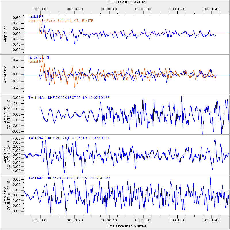
144A alexander Place, Bentonia, MS, USA - Earthquake Result Viewer
*The percent match for this event was below the threshold and hence no stack was calculated.
| Earthquake location: |
Near Coast Of Peru |
| Earthquake latitude/longitude: |
-14.2/-75.6 |
| Earthquake time(UTC): |
2012/01/30 (030) 05:11:00 GMT |
| Earthquake Depth: |
43 km |
| Earthquake Magnitude: |
6.3 MB, 5.9 MS, 6.4 MW, 6.4 MW |
| Earthquake Catalog/Contributor: |
WHDF/NEIC |
|
| Network: |
TA USArray Transportable Network (new EarthScope stations) |
| Station: |
144A alexander Place, Bentonia, MS, USA |
| Lat/Lon: |
32.63 N/90.42 W |
| Elevation: |
78 m |
|
| Distance: |
48.6 deg |
| Az: |
343.324 deg |
| Baz: |
160.74 deg |
| Ray Param: |
$rayparam |
*The percent match for this event was below the threshold and hence was not used in the summary stack. |
|
| Radial Match: |
59.174004 % |
| Radial Bump: |
400 |
| Transverse Match: |
65.88967 % |
| Transverse Bump: |
400 |
| SOD ConfigId: |
436445 |
| Insert Time: |
2012-04-11 05:27:42.478 +0000 |
| GWidth: |
2.5 |
| Max Bumps: |
400 |
| Tol: |
0.001 |
|
Signal To Noise
| Channel | StoN | STA | LTA |
| TA:144A: :BHZ:20120130T05:19:10.025012Z | 7.6385818 | 2.1666967E-6 | 2.836517E-7 |
| TA:144A: :BHN:20120130T05:19:10.025012Z | 1.1646351 | 1.0987684E-6 | 9.434444E-7 |
| TA:144A: :BHE:20120130T05:19:10.025012Z | 1.2703956 | 7.931678E-7 | 6.2434714E-7 |
| Arrivals |
| Ps | |
| PpPs | |
| PsPs/PpSs | |


