You are here: Home > Network List > UW - Pacific Northwest Regional Seismic Network Stations List
> Station LEBA Lebam, WA, USA > Earthquake Result Viewer
LEBA Lebam, WA, USA - Earthquake Result Viewer
*The percent match for this event was below the threshold and hence no stack was calculated.
| Earthquake location: |
Near Coast Of Peru |
| Earthquake latitude/longitude: |
-14.2/-75.6 |
| Earthquake time(UTC): |
2012/01/30 (030) 05:11:00 GMT |
| Earthquake Depth: |
43 km |
| Earthquake Magnitude: |
6.3 MB, 5.9 MS, 6.4 MW, 6.4 MW |
| Earthquake Catalog/Contributor: |
WHDF/NEIC |
|
| Network: |
UW Pacific Northwest Regional Seismic Network |
| Station: |
LEBA Lebam, WA, USA |
| Lat/Lon: |
46.55 N/123.56 W |
| Elevation: |
73 m |
|
| Distance: |
74.2 deg |
| Az: |
327.825 deg |
| Baz: |
131.552 deg |
| Ray Param: |
$rayparam |
*The percent match for this event was below the threshold and hence was not used in the summary stack. |
|
| Radial Match: |
60.34429 % |
| Radial Bump: |
400 |
| Transverse Match: |
51.114902 % |
| Transverse Bump: |
400 |
| SOD ConfigId: |
436445 |
| Insert Time: |
2012-04-11 05:50:49.598 +0000 |
| GWidth: |
2.5 |
| Max Bumps: |
400 |
| Tol: |
0.001 |
|
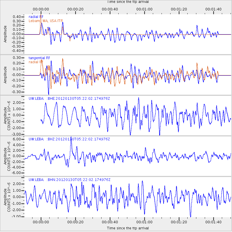
Signal To Noise
| Channel | StoN | STA | LTA |
| UW:LEBA: :BHZ:20120130T05:22:02.174976Z | 2.0749567 | 1.0379098E-6 | 5.0020793E-7 |
| UW:LEBA: :BHN:20120130T05:22:02.174976Z | 0.81457007 | 5.775896E-7 | 7.09073E-7 |
| UW:LEBA: :BHE:20120130T05:22:02.174976Z | 0.8175988 | 9.2451586E-7 | 1.1307696E-6 |
| Arrivals |
| Ps | |
| PpPs | |
| PsPs/PpSs | |


