MUR Murrieta - Earthquake Result Viewer
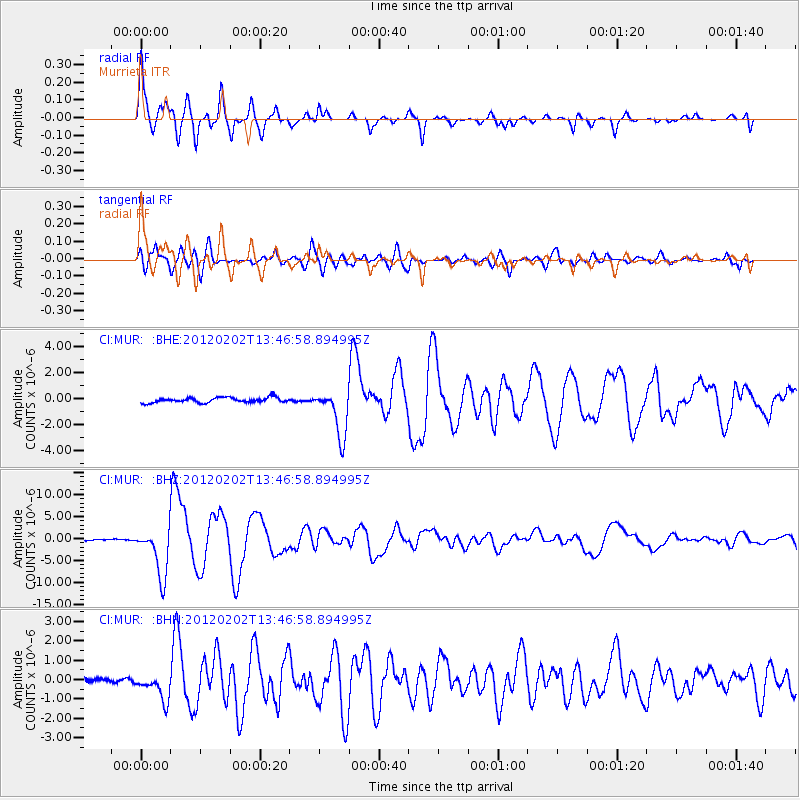
Earthquake location: Vanuatu Islands
Earthquake latitude/longitude: -17.8/167.1
Earthquake time(UTC): 2012/02/02 (033) 13:34:40 GMT
Earthquake Depth: 23 km
Earthquake Magnitude: 6.5 MB, 6.9 MS, 7.1 MW, 7.1 MW
Earthquake Catalog/Contributor: WHDF/NEIC
Network: CI Caltech Regional Seismic Network
Station: MUR Murrieta
Lat/Lon: 33.60 N/117.20 W
Elevation: 562 m
Distance: 88.3 deg
Az: 53.999 deg
Baz: 247.42 deg
Ray Param: 0.042644423
Estimated Moho Depth: 33.25 km
Estimated Crust Vp/Vs: 1.60
Assumed Crust Vp: 6.264 km/s
Estimated Crust Vs: 3.915 km/s
Estimated Crust Poisson's Ratio: 0.18
Radial Match: 97.22577 %
Radial Bump: 304
Transverse Match: 91.81017 %
Transverse Bump: 400
SOD ConfigId: 436445
Insert Time: 2012-04-11 06:23:04.615 +0000
GWidth: 2.5
Max Bumps: 400
Tol: 0.001

Signal To Noise

ChannelStoNSTALTA
CI:MUR: :BHZ:20120202T13:46:58.894995Z22.2382975.6374142E-62.5350027E-7
CI:MUR: :BHN:20120202T13:46:58.894995Z3.1322697.03748E-72.2467674E-7
CI:MUR: :BHE:20120202T13:46:58.894995Z9.2458261.8233221E-61.9720491E-7
Arrivals
Ps3.3 SECOND
PpPs13 SECOND
PsPs/PpSs17 SECOND