LON Longmire (broad-band and DWWSSN) - Earthquake Result Viewer
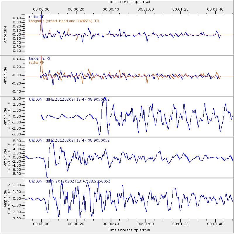
Earthquake location: Vanuatu Islands
Earthquake latitude/longitude: -17.8/167.1
Earthquake time(UTC): 2012/02/02 (033) 13:34:40 GMT
Earthquake Depth: 23 km
Earthquake Magnitude: 6.5 MB, 6.9 MS, 7.1 MW, 7.1 MW
Earthquake Catalog/Contributor: WHDF/NEIC
Network: UW Pacific Northwest Regional Seismic Network
Station: LON Longmire (broad-band and DWWSSN)
Lat/Lon: 46.75 N/121.81 W
Elevation: 850 m
Distance: 90.5 deg
Az: 40.572 deg
Baz: 244.293 deg
Ray Param: 0.04166856
Estimated Moho Depth: 64.5 km
Estimated Crust Vp/Vs: 1.85
Assumed Crust Vp: 6.597 km/s
Estimated Crust Vs: 3.576 km/s
Estimated Crust Poisson's Ratio: 0.29
Radial Match: 94.05757 %
Radial Bump: 400
Transverse Match: 80.20964 %
Transverse Bump: 400
SOD ConfigId: 436445
Insert Time: 2012-04-11 06:34:36.755 +0000
GWidth: 2.5
Max Bumps: 400
Tol: 0.001

Signal To Noise

ChannelStoNSTALTA
UW:LON: :BHZ:20120202T13:47:08.905005Z12.1361934.456299E-63.6719084E-7
UW:LON: :BHN:20120202T13:47:08.905005Z8.7216028.8766274E-71.01777474E-7
UW:LON: :BHE:20120202T13:47:08.905005Z5.7643451.3534915E-62.3480403E-7
Arrivals
Ps8.4 SECOND
PpPs27 SECOND
PsPs/PpSs36 SECOND