You are here: Home > Network List > CI - Caltech Regional Seismic Network Stations List
> Station DAN Danby, California, USA > Earthquake Result Viewer
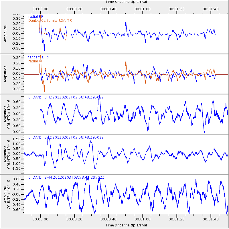
DAN Danby, California, USA - Earthquake Result Viewer
*The percent match for this event was below the threshold and hence no stack was calculated.
| Earthquake location: |
Vanuatu Islands |
| Earthquake latitude/longitude: |
-17.4/167.3 |
| Earthquake time(UTC): |
2012/02/03 (034) 03:46:21 GMT |
| Earthquake Depth: |
8.0 km |
| Earthquake Magnitude: |
5.9 MB, 5.8 MS, 6.1 MW, 6.1 MW |
| Earthquake Catalog/Contributor: |
WHDF/NEIC |
|
| Network: |
CI Caltech Regional Seismic Network |
| Station: |
DAN Danby, California, USA |
| Lat/Lon: |
34.64 N/115.38 W |
| Elevation: |
398 m |
|
| Distance: |
89.7 deg |
| Az: |
53.564 deg |
| Baz: |
248.706 deg |
| Ray Param: |
$rayparam |
*The percent match for this event was below the threshold and hence was not used in the summary stack. |
|
| Radial Match: |
71.930435 % |
| Radial Bump: |
400 |
| Transverse Match: |
67.25249 % |
| Transverse Bump: |
400 |
| SOD ConfigId: |
436445 |
| Insert Time: |
2012-04-11 06:53:41.506 +0000 |
| GWidth: |
2.5 |
| Max Bumps: |
400 |
| Tol: |
0.001 |
|
Signal To Noise
| Channel | StoN | STA | LTA |
| CI:DAN: :BHZ:20120203T03:58:48.29502Z | 3.6733036 | 7.865108E-7 | 2.1411537E-7 |
| CI:DAN: :BHN:20120203T03:58:48.29502Z | 1.7354908 | 2.76061E-7 | 1.5906797E-7 |
| CI:DAN: :BHE:20120203T03:58:48.29502Z | 1.283429 | 3.859481E-7 | 3.0071638E-7 |
| Arrivals |
| Ps | |
| PpPs | |
| PsPs/PpSs | |


