You are here: Home > Network List > TA - USArray Transportable Network (new EarthScope stations) Stations List
> Station R11A Troy Canyon, Currant, NV, USA > Earthquake Result Viewer
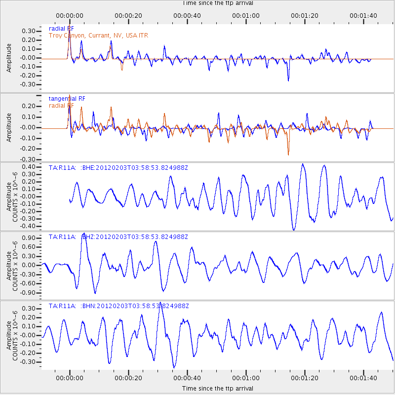
R11A Troy Canyon, Currant, NV, USA - Earthquake Result Viewer
*The percent match for this event was below the threshold and hence no stack was calculated.
| Earthquake location: |
Vanuatu Islands |
| Earthquake latitude/longitude: |
-17.4/167.3 |
| Earthquake time(UTC): |
2012/02/03 (034) 03:46:21 GMT |
| Earthquake Depth: |
8.0 km |
| Earthquake Magnitude: |
5.9 MB, 5.8 MS, 6.1 MW, 6.1 MW |
| Earthquake Catalog/Contributor: |
WHDF/NEIC |
|
| Network: |
TA USArray Transportable Network (new EarthScope stations) |
| Station: |
R11A Troy Canyon, Currant, NV, USA |
| Lat/Lon: |
38.35 N/115.59 W |
| Elevation: |
1756 m |
|
| Distance: |
90.9 deg |
| Az: |
50.053 deg |
| Baz: |
248.605 deg |
| Ray Param: |
$rayparam |
*The percent match for this event was below the threshold and hence was not used in the summary stack. |
|
| Radial Match: |
66.48108 % |
| Radial Bump: |
400 |
| Transverse Match: |
60.85099 % |
| Transverse Bump: |
400 |
| SOD ConfigId: |
436445 |
| Insert Time: |
2012-04-11 07:01:54.937 +0000 |
| GWidth: |
2.5 |
| Max Bumps: |
400 |
| Tol: |
0.001 |
|
Signal To Noise
| Channel | StoN | STA | LTA |
| TA:R11A: :BHZ:20120203T03:58:53.824988Z | 3.6959658 | 5.263938E-7 | 1.424239E-7 |
| TA:R11A: :BHN:20120203T03:58:53.824988Z | 1.1059275 | 7.841238E-8 | 7.090192E-8 |
| TA:R11A: :BHE:20120203T03:58:53.824988Z | 1.4583805 | 1.2872282E-7 | 8.8264215E-8 |
| Arrivals |
| Ps | |
| PpPs | |
| PsPs/PpSs | |


