You are here: Home > Network List > UW - Pacific Northwest Regional Seismic Network Stations List
> Station UMAT Pilot Rock, OR, USA > Earthquake Result Viewer
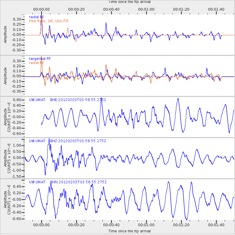
UMAT Pilot Rock, OR, USA - Earthquake Result Viewer
*The percent match for this event was below the threshold and hence no stack was calculated.
| Earthquake location: |
Vanuatu Islands |
| Earthquake latitude/longitude: |
-17.4/167.3 |
| Earthquake time(UTC): |
2012/02/03 (034) 03:46:21 GMT |
| Earthquake Depth: |
8.0 km |
| Earthquake Magnitude: |
5.9 MB, 5.8 MS, 6.1 MW, 6.1 MW |
| Earthquake Catalog/Contributor: |
WHDF/NEIC |
|
| Network: |
UW Pacific Northwest Regional Seismic Network |
| Station: |
UMAT Pilot Rock, OR, USA |
| Lat/Lon: |
45.29 N/118.96 W |
| Elevation: |
1318 m |
|
| Distance: |
91.2 deg |
| Az: |
42.68 deg |
| Baz: |
246.499 deg |
| Ray Param: |
$rayparam |
*The percent match for this event was below the threshold and hence was not used in the summary stack. |
|
| Radial Match: |
72.70265 % |
| Radial Bump: |
339 |
| Transverse Match: |
49.029366 % |
| Transverse Bump: |
299 |
| SOD ConfigId: |
436445 |
| Insert Time: |
2012-04-11 07:05:58.595 +0000 |
| GWidth: |
2.5 |
| Max Bumps: |
400 |
| Tol: |
0.001 |
|
Signal To Noise
| Channel | StoN | STA | LTA |
| UW:UMAT: :BHZ:20120203T03:58:55.275Z | 7.0629797 | 7.2630564E-7 | 1.0283275E-7 |
| UW:UMAT: :BHN:20120203T03:58:55.275Z | 2.5035574 | 2.4533946E-7 | 9.799634E-8 |
| UW:UMAT: :BHE:20120203T03:58:55.275Z | 1.6035663 | 3.165697E-7 | 1.9741603E-7 |
| Arrivals |
| Ps | |
| PpPs | |
| PsPs/PpSs | |


