You are here: Home > Network List > UW - Pacific Northwest Regional Seismic Network Stations List
> Station LEBA Lebam, WA, USA > Earthquake Result Viewer
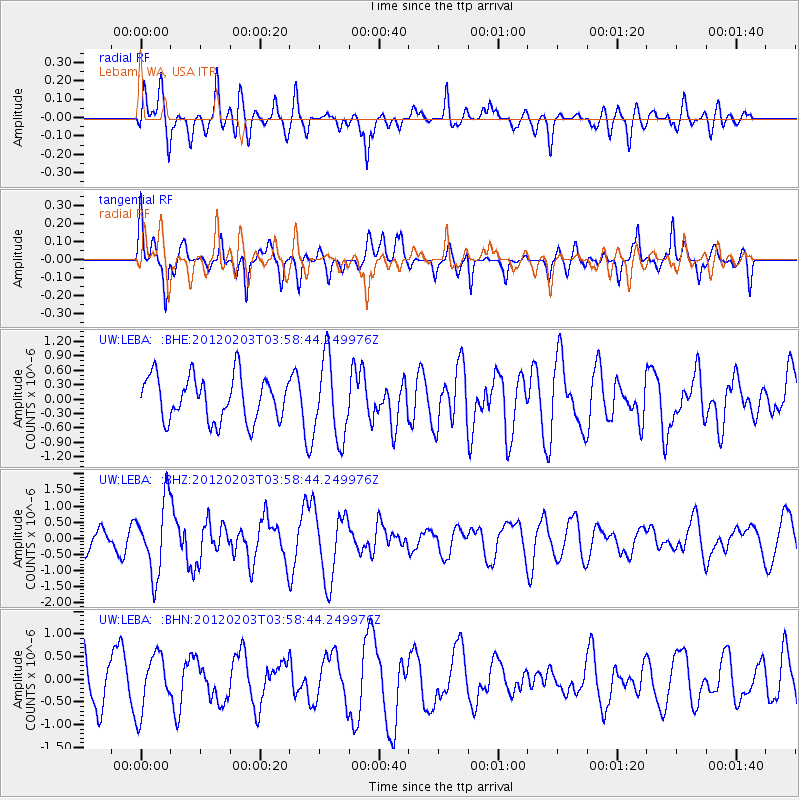
LEBA Lebam, WA, USA - Earthquake Result Viewer
*The percent match for this event was below the threshold and hence no stack was calculated.
| Earthquake location: |
Vanuatu Islands |
| Earthquake latitude/longitude: |
-17.4/167.3 |
| Earthquake time(UTC): |
2012/02/03 (034) 03:46:21 GMT |
| Earthquake Depth: |
8.0 km |
| Earthquake Magnitude: |
5.9 MB, 5.8 MS, 6.1 MW, 6.1 MW |
| Earthquake Catalog/Contributor: |
WHDF/NEIC |
|
| Network: |
UW Pacific Northwest Regional Seismic Network |
| Station: |
LEBA Lebam, WA, USA |
| Lat/Lon: |
46.55 N/123.56 W |
| Elevation: |
73 m |
|
| Distance: |
88.9 deg |
| Az: |
40.179 deg |
| Baz: |
243.205 deg |
| Ray Param: |
$rayparam |
*The percent match for this event was below the threshold and hence was not used in the summary stack. |
|
| Radial Match: |
44.89148 % |
| Radial Bump: |
400 |
| Transverse Match: |
58.01967 % |
| Transverse Bump: |
373 |
| SOD ConfigId: |
436445 |
| Insert Time: |
2012-04-11 07:06:09.217 +0000 |
| GWidth: |
2.5 |
| Max Bumps: |
400 |
| Tol: |
0.001 |
|
Signal To Noise
| Channel | StoN | STA | LTA |
| UW:LEBA: :BHZ:20120203T03:58:44.249976Z | 2.3428507 | 1.1147257E-6 | 4.7579886E-7 |
| UW:LEBA: :BHN:20120203T03:58:44.249976Z | 1.7486951 | 6.307319E-7 | 3.6068715E-7 |
| UW:LEBA: :BHE:20120203T03:58:44.249976Z | 1.8057833 | 8.2701166E-7 | 4.5797947E-7 |
| Arrivals |
| Ps | |
| PpPs | |
| PsPs/PpSs | |


