You are here: Home > Network List > TA - USArray Transportable Network (new EarthScope stations) Stations List
> Station L39A Vinton, IA, USA > Earthquake Result Viewer
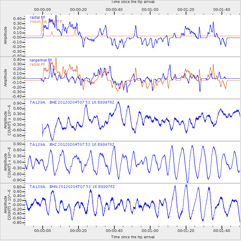
L39A Vinton, IA, USA - Earthquake Result Viewer
*The percent match for this event was below the threshold and hence no stack was calculated.
| Earthquake location: |
Tonga Islands |
| Earthquake latitude/longitude: |
-20.5/-174.0 |
| Earthquake time(UTC): |
2012/02/04 (035) 07:40:12 GMT |
| Earthquake Depth: |
8.0 km |
| Earthquake Magnitude: |
5.5 MB, 5.5 MS, 5.8 MW, 5.7 MW |
| Earthquake Catalog/Contributor: |
WHDF/NEIC |
|
| Network: |
TA USArray Transportable Network (new EarthScope stations) |
| Station: |
L39A Vinton, IA, USA |
| Lat/Lon: |
42.12 N/92.00 W |
| Elevation: |
261 m |
|
| Distance: |
97.8 deg |
| Az: |
48.049 deg |
| Baz: |
249.543 deg |
| Ray Param: |
$rayparam |
*The percent match for this event was below the threshold and hence was not used in the summary stack. |
|
| Radial Match: |
43.286278 % |
| Radial Bump: |
400 |
| Transverse Match: |
48.95534 % |
| Transverse Bump: |
400 |
| SOD ConfigId: |
436445 |
| Insert Time: |
2012-04-11 07:57:45.968 +0000 |
| GWidth: |
2.5 |
| Max Bumps: |
400 |
| Tol: |
0.001 |
|
Signal To Noise
| Channel | StoN | STA | LTA |
| TA:L39A: :BHZ:20120204T07:53:16.899976Z | 0.8599796 | 3.093291E-7 | 3.596935E-7 |
| TA:L39A: :BHN:20120204T07:53:16.899976Z | 1.9546131 | 2.8902454E-7 | 1.4786791E-7 |
| TA:L39A: :BHE:20120204T07:53:16.899976Z | 0.784522 | 2.9718802E-7 | 3.7881415E-7 |
| Arrivals |
| Ps | |
| PpPs | |
| PsPs/PpSs | |


