You are here: Home > Network List > TA - USArray Transportable Network (new EarthScope stations) Stations List
> Station T44A Benton, MO, USA > Earthquake Result Viewer
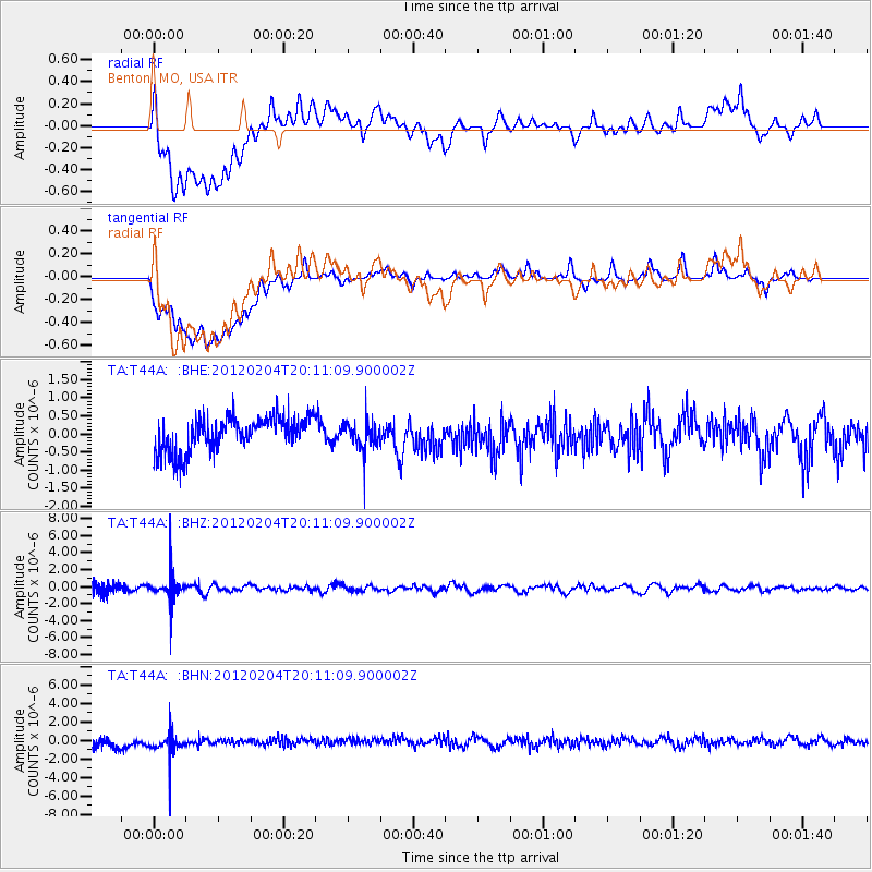
T44A Benton, MO, USA - Earthquake Result Viewer
*The percent match for this event was below the threshold and hence no stack was calculated.
| Earthquake location: |
Vancouver Island, Canada Region |
| Earthquake latitude/longitude: |
48.9/-127.9 |
| Earthquake time(UTC): |
2012/02/04 (035) 20:05:31 GMT |
| Earthquake Depth: |
15 km |
| Earthquake Magnitude: |
5.5 MB, 5.3 MS, 5.6 MW, 5.7 MW |
| Earthquake Catalog/Contributor: |
WHDF/NEIC |
|
| Network: |
TA USArray Transportable Network (new EarthScope stations) |
| Station: |
T44A Benton, MO, USA |
| Lat/Lon: |
37.09 N/89.59 W |
| Elevation: |
133 m |
|
| Distance: |
30.1 deg |
| Az: |
98.604 deg |
| Baz: |
305.303 deg |
| Ray Param: |
$rayparam |
*The percent match for this event was below the threshold and hence was not used in the summary stack. |
|
| Radial Match: |
41.233536 % |
| Radial Bump: |
400 |
| Transverse Match: |
39.058994 % |
| Transverse Bump: |
400 |
| SOD ConfigId: |
436445 |
| Insert Time: |
2012-04-11 08:31:54.685 +0000 |
| GWidth: |
2.5 |
| Max Bumps: |
400 |
| Tol: |
0.001 |
|
Signal To Noise
| Channel | StoN | STA | LTA |
| TA:T44A: :BHZ:20120204T20:11:09.900002Z | 2.8203404 | 1.4454915E-6 | 5.125238E-7 |
| TA:T44A: :BHN:20120204T20:11:09.900002Z | 1.5530142 | 1.2013681E-6 | 7.7357186E-7 |
| TA:T44A: :BHE:20120204T20:11:09.900002Z | 0.81317246 | 3.8236257E-7 | 4.7021092E-7 |
| Arrivals |
| Ps | |
| PpPs | |
| PsPs/PpSs | |


