You are here: Home > Network List > CI - Caltech Regional Seismic Network Stations List
> Station LRL Laurel Mtn Radio Fac, Ridgecrest, CA, USA > Earthquake Result Viewer
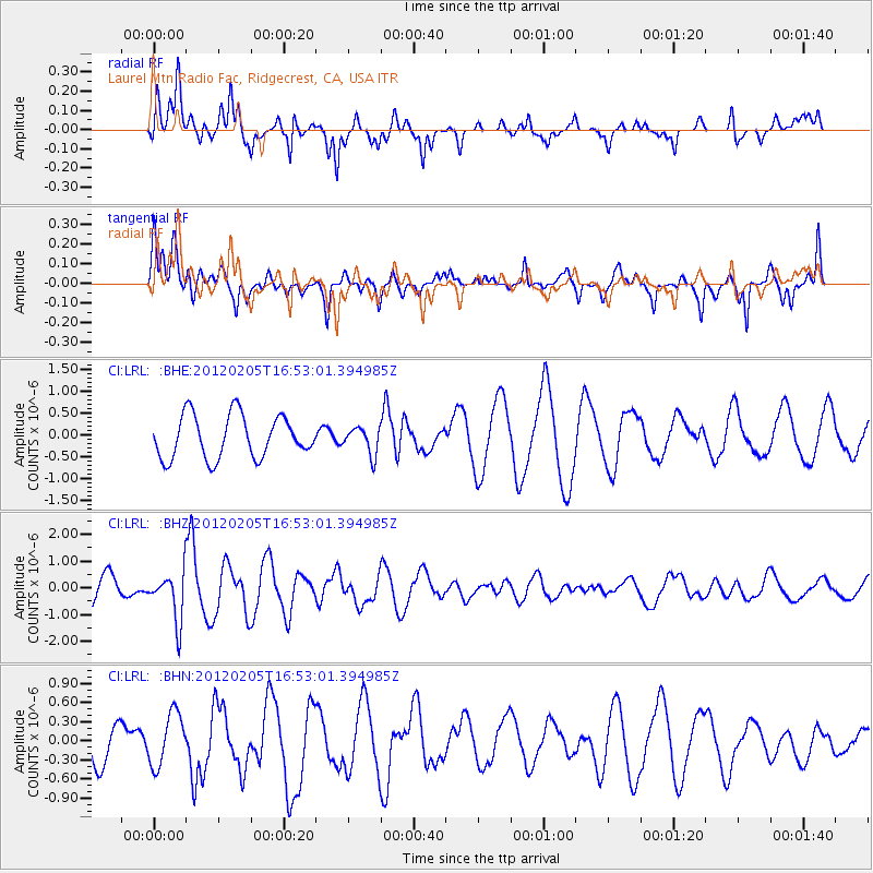
LRL Laurel Mtn Radio Fac, Ridgecrest, CA, USA - Earthquake Result Viewer
*The percent match for this event was below the threshold and hence no stack was calculated.
| Earthquake location: |
Vanuatu Islands |
| Earthquake latitude/longitude: |
-17.9/167.2 |
| Earthquake time(UTC): |
2012/02/05 (036) 16:40:39 GMT |
| Earthquake Depth: |
8.0 km |
| Earthquake Magnitude: |
5.9 MB, 5.7 MS, 6.1 MW, 6.0 MW |
| Earthquake Catalog/Contributor: |
WHDF/NEIC |
|
| Network: |
CI Caltech Regional Seismic Network |
| Station: |
LRL Laurel Mtn Radio Fac, Ridgecrest, CA, USA |
| Lat/Lon: |
35.48 N/117.68 W |
| Elevation: |
1340 m |
|
| Distance: |
88.7 deg |
| Az: |
52.082 deg |
| Baz: |
246.946 deg |
| Ray Param: |
$rayparam |
*The percent match for this event was below the threshold and hence was not used in the summary stack. |
|
| Radial Match: |
52.224728 % |
| Radial Bump: |
331 |
| Transverse Match: |
50.321888 % |
| Transverse Bump: |
354 |
| SOD ConfigId: |
436445 |
| Insert Time: |
2012-04-21 05:06:08.909 +0000 |
| GWidth: |
2.5 |
| Max Bumps: |
400 |
| Tol: |
0.001 |
|
Signal To Noise
| Channel | StoN | STA | LTA |
| CI:LRL: :BHZ:20120205T16:53:01.394985Z | 2.05681 | 9.1764184E-7 | 4.461481E-7 |
| CI:LRL: :BHN:20120205T16:53:01.394985Z | 0.706982 | 4.1408086E-7 | 5.857021E-7 |
| CI:LRL: :BHE:20120205T16:53:01.394985Z | 0.62864125 | 3.0822335E-7 | 4.9030086E-7 |
| Arrivals |
| Ps | |
| PpPs | |
| PsPs/PpSs | |


