You are here: Home > Network List > IW - Intermountain West Stations List
> Station PLID Pearl Lake, Idaho, USA > Earthquake Result Viewer
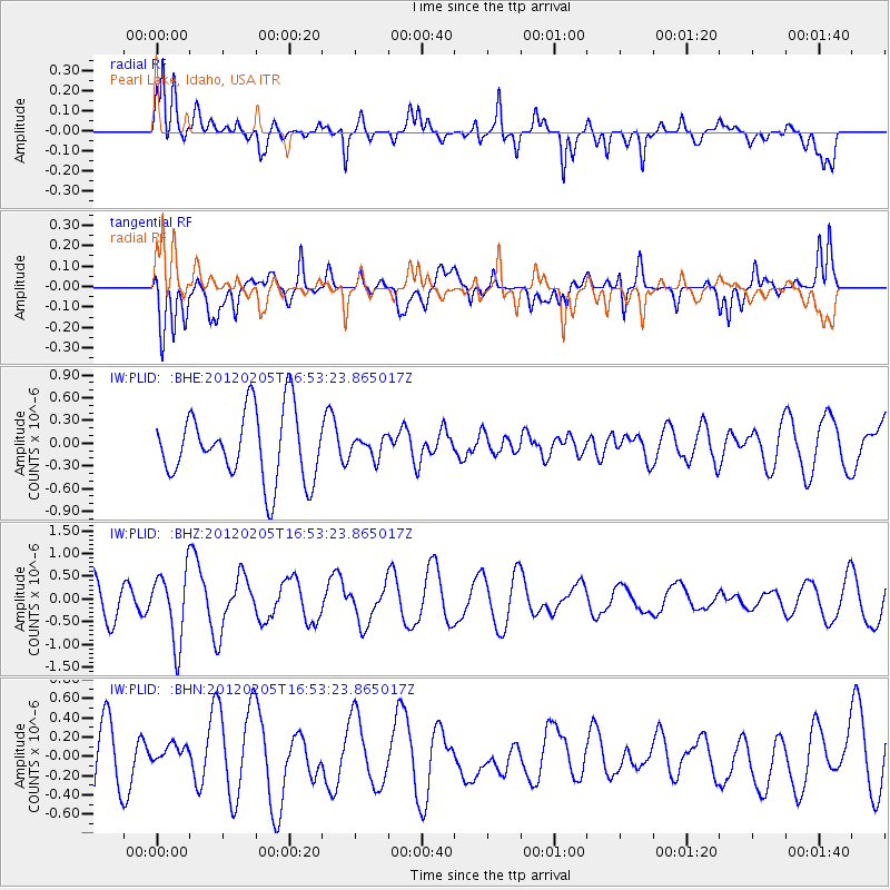
PLID Pearl Lake, Idaho, USA - Earthquake Result Viewer
*The percent match for this event was below the threshold and hence no stack was calculated.
| Earthquake location: |
Vanuatu Islands |
| Earthquake latitude/longitude: |
-17.9/167.2 |
| Earthquake time(UTC): |
2012/02/05 (036) 16:40:39 GMT |
| Earthquake Depth: |
8.0 km |
| Earthquake Magnitude: |
5.9 MB, 5.7 MS, 6.1 MW, 6.0 MW |
| Earthquake Catalog/Contributor: |
WHDF/NEIC |
|
| Network: |
IW Intermountain West |
| Station: |
PLID Pearl Lake, Idaho, USA |
| Lat/Lon: |
45.09 N/116.00 W |
| Elevation: |
2164 m |
|
| Distance: |
93.5 deg |
| Az: |
43.704 deg |
| Baz: |
248.197 deg |
| Ray Param: |
$rayparam |
*The percent match for this event was below the threshold and hence was not used in the summary stack. |
|
| Radial Match: |
64.55335 % |
| Radial Bump: |
400 |
| Transverse Match: |
47.34174 % |
| Transverse Bump: |
400 |
| SOD ConfigId: |
436445 |
| Insert Time: |
2012-04-21 05:10:55.490 +0000 |
| GWidth: |
2.5 |
| Max Bumps: |
400 |
| Tol: |
0.001 |
|
Signal To Noise
| Channel | StoN | STA | LTA |
| IW:PLID: :BHZ:20120205T16:53:23.865017Z | 1.8991975 | 7.7067875E-7 | 4.057918E-7 |
| IW:PLID: :BHN:20120205T16:53:23.865017Z | 0.23432273 | 1.05053054E-7 | 4.4832635E-7 |
| IW:PLID: :BHE:20120205T16:53:23.865017Z | 0.28409398 | 1.2993476E-7 | 4.573654E-7 |
| Arrivals |
| Ps | |
| PpPs | |
| PsPs/PpSs | |


