You are here: Home > Network List > UW - Pacific Northwest Regional Seismic Network Stations List
> Station HOOD Mt Hood Meadows, OR CREST BB SMO > Earthquake Result Viewer
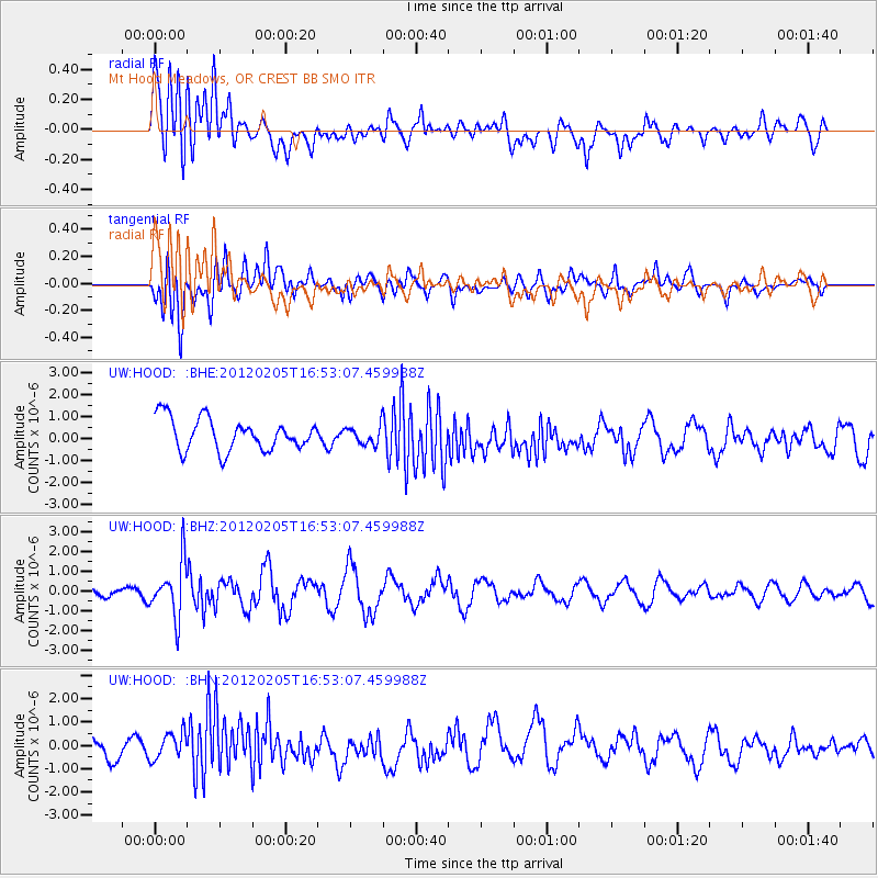
HOOD Mt Hood Meadows, OR CREST BB SMO - Earthquake Result Viewer
*The percent match for this event was below the threshold and hence no stack was calculated.
| Earthquake location: |
Vanuatu Islands |
| Earthquake latitude/longitude: |
-17.9/167.2 |
| Earthquake time(UTC): |
2012/02/05 (036) 16:40:39 GMT |
| Earthquake Depth: |
8.0 km |
| Earthquake Magnitude: |
5.9 MB, 5.7 MS, 6.1 MW, 6.0 MW |
| Earthquake Catalog/Contributor: |
WHDF/NEIC |
|
| Network: |
UW Pacific Northwest Regional Seismic Network |
| Station: |
HOOD Mt Hood Meadows, OR CREST BB SMO |
| Lat/Lon: |
45.32 N/121.65 W |
| Elevation: |
1520 m |
|
| Distance: |
90.0 deg |
| Az: |
41.879 deg |
| Baz: |
244.254 deg |
| Ray Param: |
$rayparam |
*The percent match for this event was below the threshold and hence was not used in the summary stack. |
|
| Radial Match: |
60.02781 % |
| Radial Bump: |
400 |
| Transverse Match: |
59.45928 % |
| Transverse Bump: |
400 |
| SOD ConfigId: |
436445 |
| Insert Time: |
2012-04-21 05:16:35.676 +0000 |
| GWidth: |
2.5 |
| Max Bumps: |
400 |
| Tol: |
0.001 |
|
Signal To Noise
| Channel | StoN | STA | LTA |
| UW:HOOD: :BHZ:20120205T16:53:07.459988Z | 5.0660543 | 1.3611202E-6 | 2.686746E-7 |
| UW:HOOD: :BHN:20120205T16:53:07.459988Z | 0.8144672 | 5.7232234E-7 | 7.026954E-7 |
| UW:HOOD: :BHE:20120205T16:53:07.459988Z | 0.58354175 | 4.2027224E-7 | 7.2020936E-7 |
| Arrivals |
| Ps | |
| PpPs | |
| PsPs/PpSs | |


