You are here: Home > Network List > UW - Pacific Northwest Regional Seismic Network Stations List
> Station LEBA Lebam, WA, USA > Earthquake Result Viewer
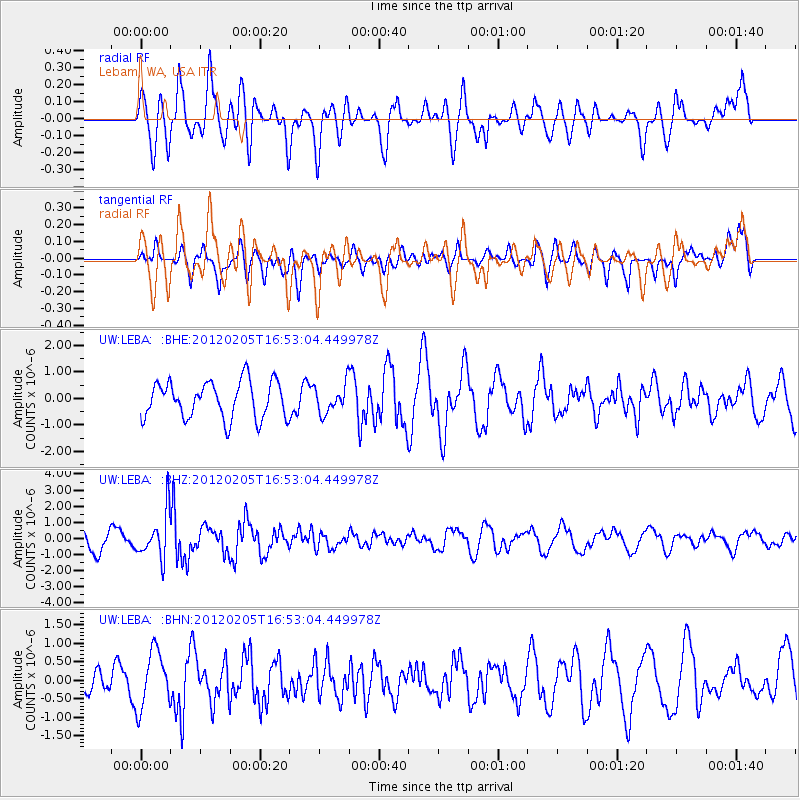
LEBA Lebam, WA, USA - Earthquake Result Viewer
*The percent match for this event was below the threshold and hence no stack was calculated.
| Earthquake location: |
Vanuatu Islands |
| Earthquake latitude/longitude: |
-17.9/167.2 |
| Earthquake time(UTC): |
2012/02/05 (036) 16:40:39 GMT |
| Earthquake Depth: |
8.0 km |
| Earthquake Magnitude: |
5.9 MB, 5.7 MS, 6.1 MW, 6.0 MW |
| Earthquake Catalog/Contributor: |
WHDF/NEIC |
|
| Network: |
UW Pacific Northwest Regional Seismic Network |
| Station: |
LEBA Lebam, WA, USA |
| Lat/Lon: |
46.55 N/123.56 W |
| Elevation: |
73 m |
|
| Distance: |
89.3 deg |
| Az: |
40.189 deg |
| Baz: |
242.876 deg |
| Ray Param: |
$rayparam |
*The percent match for this event was below the threshold and hence was not used in the summary stack. |
|
| Radial Match: |
57.50292 % |
| Radial Bump: |
400 |
| Transverse Match: |
57.204674 % |
| Transverse Bump: |
400 |
| SOD ConfigId: |
436445 |
| Insert Time: |
2012-04-21 05:17:19.135 +0000 |
| GWidth: |
2.5 |
| Max Bumps: |
400 |
| Tol: |
0.001 |
|
Signal To Noise
| Channel | StoN | STA | LTA |
| UW:LEBA: :BHZ:20120205T16:53:04.449978Z | 2.1444216 | 1.4107932E-6 | 6.578898E-7 |
| UW:LEBA: :BHN:20120205T16:53:04.449978Z | 2.4252665 | 7.661536E-7 | 3.159049E-7 |
| UW:LEBA: :BHE:20120205T16:53:04.449978Z | 0.7659918 | 5.294688E-7 | 6.9121995E-7 |
| Arrivals |
| Ps | |
| PpPs | |
| PsPs/PpSs | |


