You are here: Home > Network List > CI - Caltech Regional Seismic Network Stations List
> Station SHO Shoshone, CA, USA > Earthquake Result Viewer
SHO Shoshone, CA, USA - Earthquake Result Viewer
*The percent match for this event was below the threshold and hence no stack was calculated.
| Earthquake location: |
Fiji Islands Region |
| Earthquake latitude/longitude: |
-18.0/-178.5 |
| Earthquake time(UTC): |
2012/02/10 (041) 01:47:34 GMT |
| Earthquake Depth: |
582 km |
| Earthquake Magnitude: |
6.0 MB, 5.9 MW, 6.0 MW |
| Earthquake Catalog/Contributor: |
WHDF/NEIC |
|
| Network: |
CI Caltech Regional Seismic Network |
| Station: |
SHO Shoshone, CA, USA |
| Lat/Lon: |
35.90 N/116.28 W |
| Elevation: |
451 m |
|
| Distance: |
79.6 deg |
| Az: |
46.945 deg |
| Baz: |
238.939 deg |
| Ray Param: |
$rayparam |
*The percent match for this event was below the threshold and hence was not used in the summary stack. |
|
| Radial Match: |
80.32341 % |
| Radial Bump: |
400 |
| Transverse Match: |
52.604847 % |
| Transverse Bump: |
400 |
| SOD ConfigId: |
436445 |
| Insert Time: |
2012-04-21 06:08:55.910 +0000 |
| GWidth: |
2.5 |
| Max Bumps: |
400 |
| Tol: |
0.001 |
|
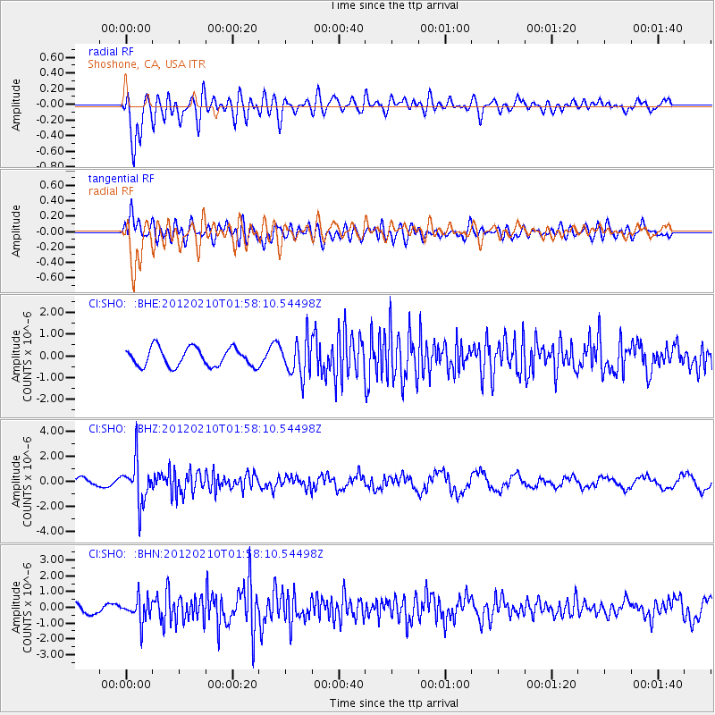
Signal To Noise
| Channel | StoN | STA | LTA |
| CI:SHO: :BHZ:20120210T01:58:10.54498Z | 5.1905985 | 1.7039463E-6 | 3.282755E-7 |
| CI:SHO: :BHN:20120210T01:58:10.54498Z | 1.868903 | 7.586749E-7 | 4.0594665E-7 |
| CI:SHO: :BHE:20120210T01:58:10.54498Z | 1.9747652 | 8.270995E-7 | 4.1883433E-7 |
| Arrivals |
| Ps | |
| PpPs | |
| PsPs/PpSs | |


