You are here: Home > Network List > CI - Caltech Regional Seismic Network Stations List
> Station DAN Danby, California, USA > Earthquake Result Viewer
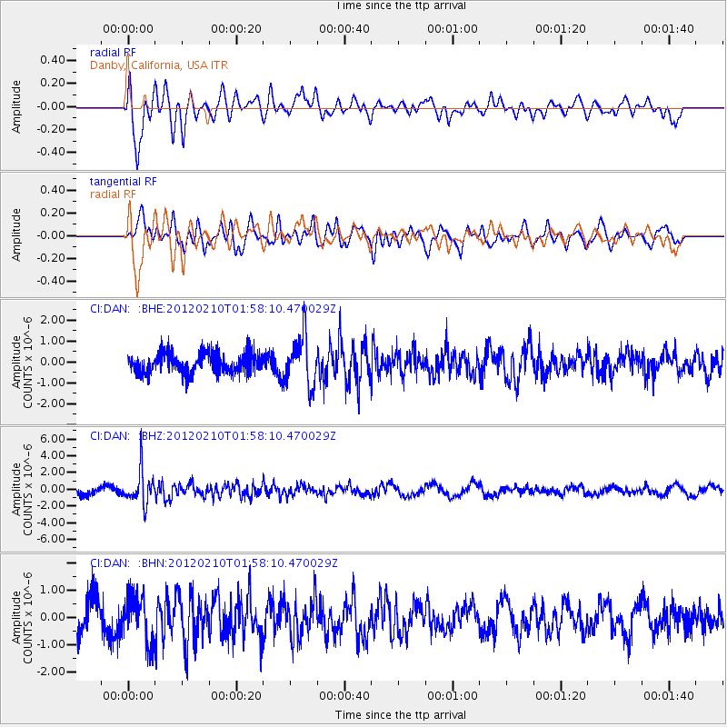
DAN Danby, California, USA - Earthquake Result Viewer
*The percent match for this event was below the threshold and hence no stack was calculated.
| Earthquake location: |
Fiji Islands Region |
| Earthquake latitude/longitude: |
-18.0/-178.5 |
| Earthquake time(UTC): |
2012/02/10 (041) 01:47:34 GMT |
| Earthquake Depth: |
582 km |
| Earthquake Magnitude: |
6.0 MB, 5.9 MW, 6.0 MW |
| Earthquake Catalog/Contributor: |
WHDF/NEIC |
|
| Network: |
CI Caltech Regional Seismic Network |
| Station: |
DAN Danby, California, USA |
| Lat/Lon: |
34.64 N/115.38 W |
| Elevation: |
398 m |
|
| Distance: |
79.6 deg |
| Az: |
48.426 deg |
| Baz: |
239.721 deg |
| Ray Param: |
$rayparam |
*The percent match for this event was below the threshold and hence was not used in the summary stack. |
|
| Radial Match: |
78.11592 % |
| Radial Bump: |
400 |
| Transverse Match: |
58.03238 % |
| Transverse Bump: |
400 |
| SOD ConfigId: |
436445 |
| Insert Time: |
2012-04-21 06:09:22.080 +0000 |
| GWidth: |
2.5 |
| Max Bumps: |
400 |
| Tol: |
0.001 |
|
Signal To Noise
| Channel | StoN | STA | LTA |
| CI:DAN: :BHZ:20120210T01:58:10.470029Z | 3.7466154 | 2.0081632E-6 | 5.3599393E-7 |
| CI:DAN: :BHN:20120210T01:58:10.470029Z | 1.4245186 | 8.539956E-7 | 5.994977E-7 |
| CI:DAN: :BHE:20120210T01:58:10.470029Z | 2.4344907 | 1.1671793E-6 | 4.794347E-7 |
| Arrivals |
| Ps | |
| PpPs | |
| PsPs/PpSs | |


