You are here: Home > Network List > IW - Intermountain West Stations List
> Station MOOW Moose Ponds, Wyoming, USA > Earthquake Result Viewer
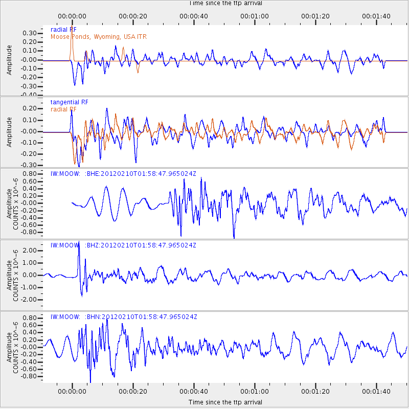
MOOW Moose Ponds, Wyoming, USA - Earthquake Result Viewer
*The percent match for this event was below the threshold and hence no stack was calculated.
| Earthquake location: |
Fiji Islands Region |
| Earthquake latitude/longitude: |
-18.0/-178.5 |
| Earthquake time(UTC): |
2012/02/10 (041) 01:47:34 GMT |
| Earthquake Depth: |
582 km |
| Earthquake Magnitude: |
6.0 MB, 5.9 MW, 6.0 MW |
| Earthquake Catalog/Contributor: |
WHDF/NEIC |
|
| Network: |
IW Intermountain West |
| Station: |
MOOW Moose Ponds, Wyoming, USA |
| Lat/Lon: |
43.75 N/110.74 W |
| Elevation: |
2128 m |
|
| Distance: |
87.2 deg |
| Az: |
42.207 deg |
| Baz: |
241.93 deg |
| Ray Param: |
$rayparam |
*The percent match for this event was below the threshold and hence was not used in the summary stack. |
|
| Radial Match: |
63.16134 % |
| Radial Bump: |
400 |
| Transverse Match: |
69.94989 % |
| Transverse Bump: |
400 |
| SOD ConfigId: |
436445 |
| Insert Time: |
2012-04-21 06:14:06.194 +0000 |
| GWidth: |
2.5 |
| Max Bumps: |
400 |
| Tol: |
0.001 |
|
Signal To Noise
| Channel | StoN | STA | LTA |
| IW:MOOW: :BHZ:20120210T01:58:47.965024Z | 8.175717 | 9.544648E-7 | 1.16743855E-7 |
| IW:MOOW: :BHN:20120210T01:58:47.965024Z | 1.9874679 | 2.9593434E-7 | 1.489002E-7 |
| IW:MOOW: :BHE:20120210T01:58:47.965024Z | 0.9201576 | 2.0386376E-7 | 2.215531E-7 |
| Arrivals |
| Ps | |
| PpPs | |
| PsPs/PpSs | |


