You are here: Home > Network List > TA - USArray Transportable Network (new EarthScope stations) Stations List
> Station G03D McMinnville, OR, USA > Earthquake Result Viewer
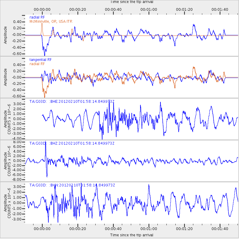
G03D McMinnville, OR, USA - Earthquake Result Viewer
*The percent match for this event was below the threshold and hence no stack was calculated.
| Earthquake location: |
Fiji Islands Region |
| Earthquake latitude/longitude: |
-18.0/-178.5 |
| Earthquake time(UTC): |
2012/02/10 (041) 01:47:34 GMT |
| Earthquake Depth: |
582 km |
| Earthquake Magnitude: |
6.0 MB, 5.9 MW, 6.0 MW |
| Earthquake Catalog/Contributor: |
WHDF/NEIC |
|
| Network: |
TA USArray Transportable Network (new EarthScope stations) |
| Station: |
G03D McMinnville, OR, USA |
| Lat/Lon: |
45.21 N/123.26 W |
| Elevation: |
222 m |
|
| Distance: |
80.4 deg |
| Az: |
36.104 deg |
| Baz: |
232.509 deg |
| Ray Param: |
$rayparam |
*The percent match for this event was below the threshold and hence was not used in the summary stack. |
|
| Radial Match: |
69.583694 % |
| Radial Bump: |
400 |
| Transverse Match: |
65.026505 % |
| Transverse Bump: |
400 |
| SOD ConfigId: |
436445 |
| Insert Time: |
2012-04-21 06:18:43.227 +0000 |
| GWidth: |
2.5 |
| Max Bumps: |
400 |
| Tol: |
0.001 |
|
Signal To Noise
| Channel | StoN | STA | LTA |
| TA:G03D: :BHZ:20120210T01:58:14.849973Z | 3.5677805 | 2.620645E-6 | 7.3453094E-7 |
| TA:G03D: :BHN:20120210T01:58:14.849973Z | 1.235699 | 1.1891509E-6 | 9.623304E-7 |
| TA:G03D: :BHE:20120210T01:58:14.849973Z | 1.8694206 | 1.6349418E-6 | 8.7457136E-7 |
| Arrivals |
| Ps | |
| PpPs | |
| PsPs/PpSs | |


