You are here: Home > Network List > TA - USArray Transportable Network (new EarthScope stations) Stations List
> Station N34A Lincoln, NE, USA > Earthquake Result Viewer
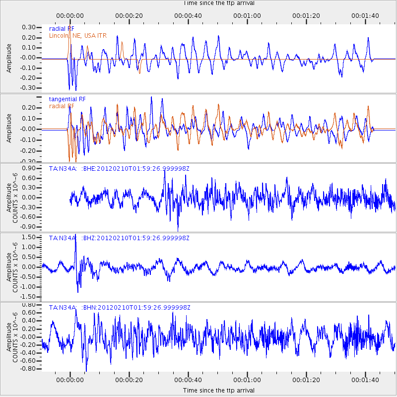
N34A Lincoln, NE, USA - Earthquake Result Viewer
*The percent match for this event was below the threshold and hence no stack was calculated.
| Earthquake location: |
Fiji Islands Region |
| Earthquake latitude/longitude: |
-18.0/-178.5 |
| Earthquake time(UTC): |
2012/02/10 (041) 01:47:34 GMT |
| Earthquake Depth: |
582 km |
| Earthquake Magnitude: |
6.0 MB, 5.9 MW, 6.0 MW |
| Earthquake Catalog/Contributor: |
WHDF/NEIC |
|
| Network: |
TA USArray Transportable Network (new EarthScope stations) |
| Station: |
N34A Lincoln, NE, USA |
| Lat/Lon: |
40.84 N/96.50 W |
| Elevation: |
401 m |
|
| Distance: |
95.7 deg |
| Az: |
49.044 deg |
| Baz: |
251.337 deg |
| Ray Param: |
$rayparam |
*The percent match for this event was below the threshold and hence was not used in the summary stack. |
|
| Radial Match: |
63.111538 % |
| Radial Bump: |
400 |
| Transverse Match: |
57.73049 % |
| Transverse Bump: |
400 |
| SOD ConfigId: |
436445 |
| Insert Time: |
2012-04-21 06:20:22.185 +0000 |
| GWidth: |
2.5 |
| Max Bumps: |
400 |
| Tol: |
0.001 |
|
Signal To Noise
| Channel | StoN | STA | LTA |
| TA:N34A: :BHZ:20120210T01:59:26.999998Z | 5.0256357 | 5.512558E-7 | 1.09688784E-7 |
| TA:N34A: :BHN:20120210T01:59:26.999998Z | 1.8445915 | 2.998944E-7 | 1.6258039E-7 |
| TA:N34A: :BHE:20120210T01:59:26.999998Z | 2.1000805 | 3.4491944E-7 | 1.6424107E-7 |
| Arrivals |
| Ps | |
| PpPs | |
| PsPs/PpSs | |


