You are here: Home > Network List > TA - USArray Transportable Network (new EarthScope stations) Stations List
> Station Q24A Divide, CO, USA > Earthquake Result Viewer
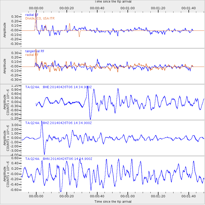
Q24A Divide, CO, USA - Earthquake Result Viewer
*The percent match for this event was below the threshold and hence no stack was calculated.
| Earthquake location: |
Tonga Islands |
| Earthquake latitude/longitude: |
-20.7/-174.7 |
| Earthquake time(UTC): |
2014/04/26 (116) 06:02:16 GMT |
| Earthquake Depth: |
10 km |
| Earthquake Magnitude: |
6.5 MWP |
| Earthquake Catalog/Contributor: |
NEIC PDE/NEIC COMCAT |
|
| Network: |
TA USArray Transportable Network (new EarthScope stations) |
| Station: |
Q24A Divide, CO, USA |
| Lat/Lon: |
38.96 N/105.15 W |
| Elevation: |
2775 m |
|
| Distance: |
88.0 deg |
| Az: |
46.953 deg |
| Baz: |
241.344 deg |
| Ray Param: |
$rayparam |
*The percent match for this event was below the threshold and hence was not used in the summary stack. |
|
| Radial Match: |
70.391 % |
| Radial Bump: |
324 |
| Transverse Match: |
64.00662 % |
| Transverse Bump: |
400 |
| SOD ConfigId: |
3390531 |
| Insert Time: |
2019-04-11 14:59:27.964 +0000 |
| GWidth: |
2.5 |
| Max Bumps: |
400 |
| Tol: |
0.001 |
|
Signal To Noise
| Channel | StoN | STA | LTA |
| TA:Q24A: :BHZ:20140426T06:14:34.900Z | 7.059097 | 1.490517E-6 | 2.1114839E-7 |
| TA:Q24A: :BHN:20140426T06:14:34.900Z | 1.2387227 | 2.1391209E-7 | 1.7268763E-7 |
| TA:Q24A: :BHE:20140426T06:14:34.900Z | 3.0962615 | 4.918786E-7 | 1.588621E-7 |
| Arrivals |
| Ps | |
| PpPs | |
| PsPs/PpSs | |


