You are here: Home > Network List > TA - USArray Transportable Network (new EarthScope stations) Stations List
> Station Y40A Okolona, AR, USA > Earthquake Result Viewer
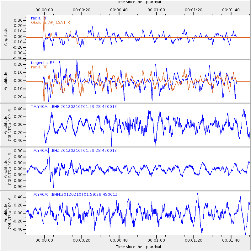
Y40A Okolona, AR, USA - Earthquake Result Viewer
*The percent match for this event was below the threshold and hence no stack was calculated.
| Earthquake location: |
Fiji Islands Region |
| Earthquake latitude/longitude: |
-18.0/-178.5 |
| Earthquake time(UTC): |
2012/02/10 (041) 01:47:34 GMT |
| Earthquake Depth: |
582 km |
| Earthquake Magnitude: |
6.0 MB, 5.9 MW, 6.0 MW |
| Earthquake Catalog/Contributor: |
WHDF/NEIC |
|
| Network: |
TA USArray Transportable Network (new EarthScope stations) |
| Station: |
Y40A Okolona, AR, USA |
| Lat/Lon: |
34.01 N/93.28 W |
| Elevation: |
117 m |
|
| Distance: |
96.1 deg |
| Az: |
56.353 deg |
| Baz: |
252.538 deg |
| Ray Param: |
$rayparam |
*The percent match for this event was below the threshold and hence was not used in the summary stack. |
|
| Radial Match: |
45.103836 % |
| Radial Bump: |
400 |
| Transverse Match: |
57.374023 % |
| Transverse Bump: |
400 |
| SOD ConfigId: |
436445 |
| Insert Time: |
2012-04-21 06:23:43.534 +0000 |
| GWidth: |
2.5 |
| Max Bumps: |
400 |
| Tol: |
0.001 |
|
Signal To Noise
| Channel | StoN | STA | LTA |
| TA:Y40A: :BHZ:20120210T01:59:28.45001Z | 2.3345013 | 4.1014172E-7 | 1.7568708E-7 |
| TA:Y40A: :BHN:20120210T01:59:28.45001Z | 0.8550546 | 1.3991239E-7 | 1.6362976E-7 |
| TA:Y40A: :BHE:20120210T01:59:28.45001Z | 0.98423517 | 1.55037E-7 | 1.5752028E-7 |
| Arrivals |
| Ps | |
| PpPs | |
| PsPs/PpSs | |


