You are here: Home > Network List > TA - USArray Transportable Network (new EarthScope stations) Stations List
> Station Z40A Long Farm, Magnolia, AR, USA > Earthquake Result Viewer
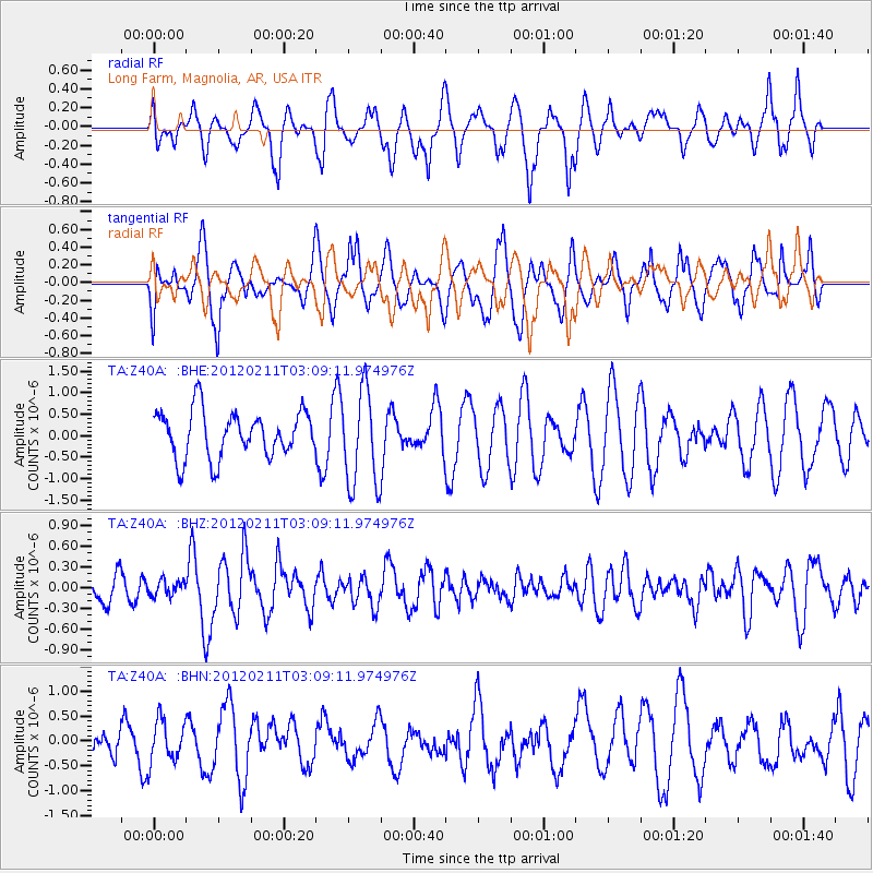
Z40A Long Farm, Magnolia, AR, USA - Earthquake Result Viewer
*The percent match for this event was below the threshold and hence no stack was calculated.
| Earthquake location: |
Near Coast Of Central Chile |
| Earthquake latitude/longitude: |
-37.5/-73.9 |
| Earthquake time(UTC): |
2012/02/11 (042) 02:58:17 GMT |
| Earthquake Depth: |
20 km |
| Earthquake Magnitude: |
5.6 MB, 5.3 MS, 5.6 MW, 5.7 MW |
| Earthquake Catalog/Contributor: |
WHDF/NEIC |
|
| Network: |
TA USArray Transportable Network (new EarthScope stations) |
| Station: |
Z40A Long Farm, Magnolia, AR, USA |
| Lat/Lon: |
33.26 N/93.40 W |
| Elevation: |
78 m |
|
| Distance: |
72.7 deg |
| Az: |
342.949 deg |
| Baz: |
163.83 deg |
| Ray Param: |
$rayparam |
*The percent match for this event was below the threshold and hence was not used in the summary stack. |
|
| Radial Match: |
64.27053 % |
| Radial Bump: |
400 |
| Transverse Match: |
41.522327 % |
| Transverse Bump: |
400 |
| SOD ConfigId: |
436445 |
| Insert Time: |
2012-04-21 06:49:25.825 +0000 |
| GWidth: |
2.5 |
| Max Bumps: |
400 |
| Tol: |
0.001 |
|
Signal To Noise
| Channel | StoN | STA | LTA |
| TA:Z40A: :BHZ:20120211T03:09:11.974976Z | 0.6471268 | 1.048761E-7 | 1.6206423E-7 |
| TA:Z40A: :BHN:20120211T03:09:11.974976Z | 1.1182144 | 4.2525187E-7 | 3.802955E-7 |
| TA:Z40A: :BHE:20120211T03:09:11.974976Z | 2.0829113 | 1.1215475E-6 | 5.3845184E-7 |
| Arrivals |
| Ps | |
| PpPs | |
| PsPs/PpSs | |


