You are here: Home > Network List > TA - USArray Transportable Network (new EarthScope stations) Stations List
> Station MSTX Muleshoe, TX, USA > Earthquake Result Viewer
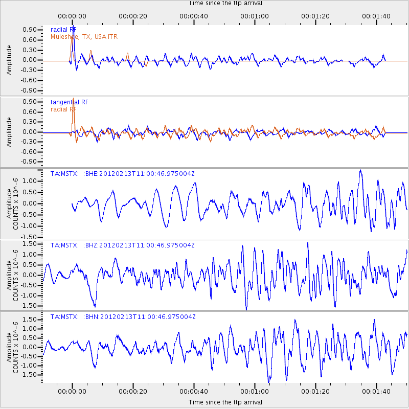
MSTX Muleshoe, TX, USA - Earthquake Result Viewer
*The percent match for this event was below the threshold and hence no stack was calculated.
| Earthquake location: |
Costa Rica |
| Earthquake latitude/longitude: |
9.2/-84.1 |
| Earthquake time(UTC): |
2012/02/13 (044) 10:55:09 GMT |
| Earthquake Depth: |
16 km |
| Earthquake Magnitude: |
5.6 MB, 5.5 MS, 5.9 MW, 5.7 MW |
| Earthquake Catalog/Contributor: |
WHDF/NEIC |
|
| Network: |
TA USArray Transportable Network (new EarthScope stations) |
| Station: |
MSTX Muleshoe, TX, USA |
| Lat/Lon: |
33.97 N/102.77 W |
| Elevation: |
1167 m |
|
| Distance: |
30.0 deg |
| Az: |
327.936 deg |
| Baz: |
140.899 deg |
| Ray Param: |
$rayparam |
*The percent match for this event was below the threshold and hence was not used in the summary stack. |
|
| Radial Match: |
66.925354 % |
| Radial Bump: |
400 |
| Transverse Match: |
57.0684 % |
| Transverse Bump: |
394 |
| SOD ConfigId: |
439822 |
| Insert Time: |
2012-04-27 08:07:43.456 +0000 |
| GWidth: |
2.5 |
| Max Bumps: |
400 |
| Tol: |
0.001 |
|
Signal To Noise
| Channel | StoN | STA | LTA |
| TA:MSTX: :BHZ:20120213T11:00:46.975004Z | 0.9279172 | 2.828418E-7 | 3.0481363E-7 |
| TA:MSTX: :BHN:20120213T11:00:46.975004Z | 0.77284026 | 2.4311254E-7 | 3.1457023E-7 |
| TA:MSTX: :BHE:20120213T11:00:46.975004Z | 2.5542336 | 6.7926015E-7 | 2.65935E-7 |
| Arrivals |
| Ps | |
| PpPs | |
| PsPs/PpSs | |


