You are here: Home > Network List > TA - USArray Transportable Network (new EarthScope stations) Stations List
> Station V55A Taylorsville, NC, USA > Earthquake Result Viewer
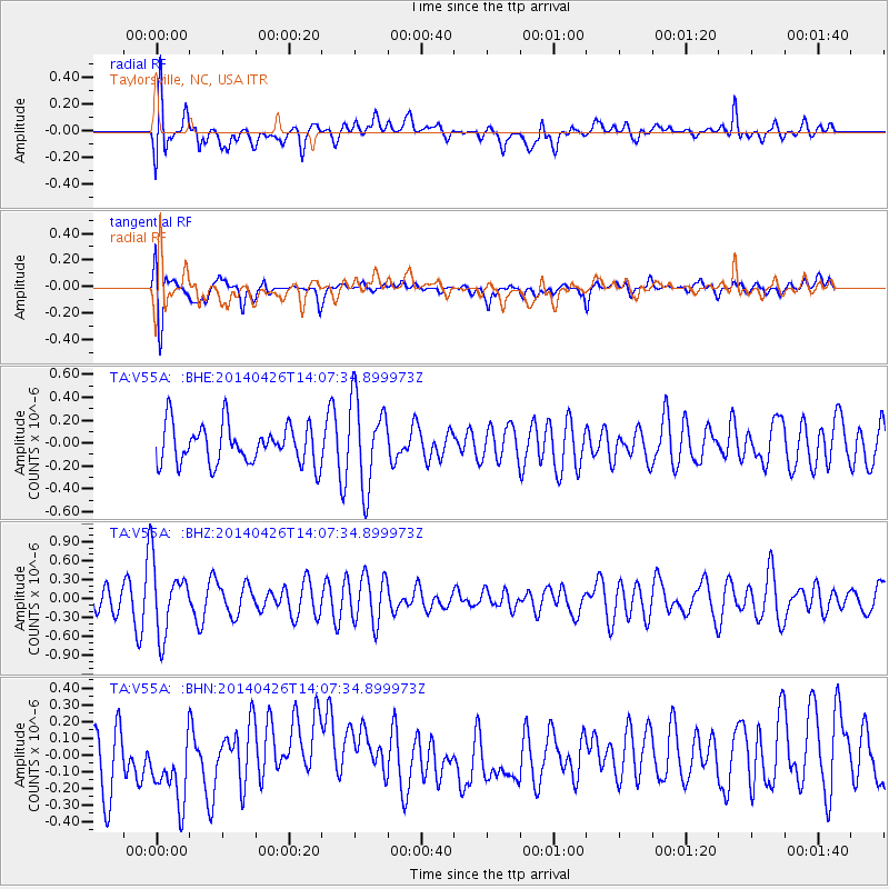
V55A Taylorsville, NC, USA - Earthquake Result Viewer
*The percent match for this event was below the threshold and hence no stack was calculated.
| Earthquake location: |
Kuril Islands |
| Earthquake latitude/longitude: |
48.5/153.3 |
| Earthquake time(UTC): |
2014/04/26 (116) 13:55:55 GMT |
| Earthquake Depth: |
131 km |
| Earthquake Magnitude: |
5.1 MW |
| Earthquake Catalog/Contributor: |
ISC/ISC |
|
| Network: |
TA USArray Transportable Network (new EarthScope stations) |
| Station: |
V55A Taylorsville, NC, USA |
| Lat/Lon: |
35.85 N/81.21 W |
| Elevation: |
306 m |
|
| Distance: |
83.0 deg |
| Az: |
41.806 deg |
| Baz: |
326.891 deg |
| Ray Param: |
$rayparam |
*The percent match for this event was below the threshold and hence was not used in the summary stack. |
|
| Radial Match: |
61.679924 % |
| Radial Bump: |
400 |
| Transverse Match: |
71.211945 % |
| Transverse Bump: |
400 |
| SOD ConfigId: |
3390531 |
| Insert Time: |
2019-04-11 15:08:31.021 +0000 |
| GWidth: |
2.5 |
| Max Bumps: |
400 |
| Tol: |
0.001 |
|
Signal To Noise
| Channel | StoN | STA | LTA |
| TA:V55A: :BHZ:20140426T14:07:34.899973Z | 2.4489658 | 5.5364455E-7 | 2.260728E-7 |
| TA:V55A: :BHN:20140426T14:07:34.899973Z | 1.2203567 | 2.197599E-7 | 1.8007842E-7 |
| TA:V55A: :BHE:20140426T14:07:34.899973Z | 2.2559702 | 3.8238048E-7 | 1.6949713E-7 |
| Arrivals |
| Ps | |
| PpPs | |
| PsPs/PpSs | |


