You are here: Home > Network List > TA - USArray Transportable Network (new EarthScope stations) Stations List
> Station I32A Karley and Nick, Howard, SD, USA > Earthquake Result Viewer
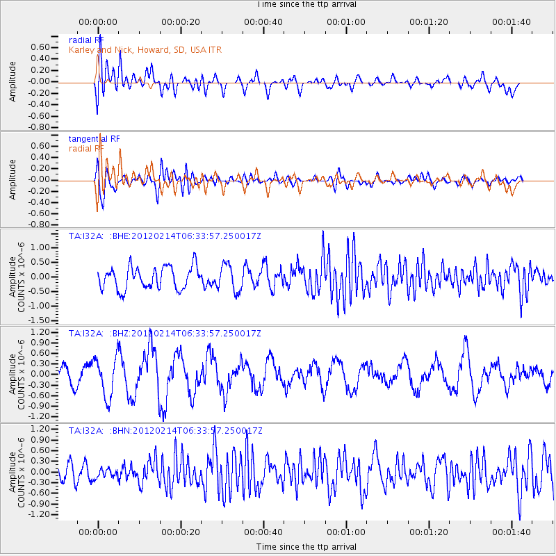
I32A Karley and Nick, Howard, SD, USA - Earthquake Result Viewer
*The percent match for this event was below the threshold and hence no stack was calculated.
| Earthquake location: |
Near East Coast Of Honshu, Japan |
| Earthquake latitude/longitude: |
36.2/141.4 |
| Earthquake time(UTC): |
2012/02/14 (045) 06:22:01 GMT |
| Earthquake Depth: |
28 km |
| Earthquake Magnitude: |
5.6 MB, 5.6 MS, 5.8 MW, 5.7 MW |
| Earthquake Catalog/Contributor: |
WHDF/NEIC |
|
| Network: |
TA USArray Transportable Network (new EarthScope stations) |
| Station: |
I32A Karley and Nick, Howard, SD, USA |
| Lat/Lon: |
44.03 N/97.46 W |
| Elevation: |
493 m |
|
| Distance: |
83.9 deg |
| Az: |
38.375 deg |
| Baz: |
315.893 deg |
| Ray Param: |
$rayparam |
*The percent match for this event was below the threshold and hence was not used in the summary stack. |
|
| Radial Match: |
60.91223 % |
| Radial Bump: |
400 |
| Transverse Match: |
49.96614 % |
| Transverse Bump: |
400 |
| SOD ConfigId: |
439822 |
| Insert Time: |
2012-04-27 09:08:15.586 +0000 |
| GWidth: |
2.5 |
| Max Bumps: |
400 |
| Tol: |
0.001 |
|
Signal To Noise
| Channel | StoN | STA | LTA |
| TA:I32A: :BHZ:20120214T06:33:57.250017Z | 2.1545644 | 5.7890014E-7 | 2.6868548E-7 |
| TA:I32A: :BHN:20120214T06:33:57.250017Z | 0.5766735 | 1.1918447E-7 | 2.0667582E-7 |
| TA:I32A: :BHE:20120214T06:33:57.250017Z | 1.226774 | 4.6646187E-7 | 3.8023458E-7 |
| Arrivals |
| Ps | |
| PpPs | |
| PsPs/PpSs | |


