You are here: Home > Network List > TA - USArray Transportable Network (new EarthScope stations) Stations List
> Station G43A Wallace, MI, USA > Earthquake Result Viewer
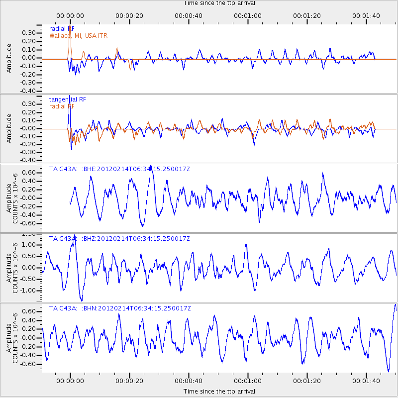
G43A Wallace, MI, USA - Earthquake Result Viewer
*The percent match for this event was below the threshold and hence no stack was calculated.
| Earthquake location: |
Near East Coast Of Honshu, Japan |
| Earthquake latitude/longitude: |
36.2/141.4 |
| Earthquake time(UTC): |
2012/02/14 (045) 06:22:01 GMT |
| Earthquake Depth: |
28 km |
| Earthquake Magnitude: |
5.6 MB, 5.6 MS, 5.8 MW, 5.7 MW |
| Earthquake Catalog/Contributor: |
WHDF/NEIC |
|
| Network: |
TA USArray Transportable Network (new EarthScope stations) |
| Station: |
G43A Wallace, MI, USA |
| Lat/Lon: |
45.26 N/87.69 W |
| Elevation: |
213 m |
|
| Distance: |
87.6 deg |
| Az: |
32.284 deg |
| Baz: |
322.299 deg |
| Ray Param: |
$rayparam |
*The percent match for this event was below the threshold and hence was not used in the summary stack. |
|
| Radial Match: |
59.81496 % |
| Radial Bump: |
400 |
| Transverse Match: |
66.03315 % |
| Transverse Bump: |
400 |
| SOD ConfigId: |
439822 |
| Insert Time: |
2012-04-27 09:12:27.411 +0000 |
| GWidth: |
2.5 |
| Max Bumps: |
400 |
| Tol: |
0.001 |
|
Signal To Noise
| Channel | StoN | STA | LTA |
| TA:G43A: :BHZ:20120214T06:34:15.250017Z | 2.0984778 | 9.3979327E-7 | 4.478452E-7 |
| TA:G43A: :BHN:20120214T06:34:15.250017Z | 0.7101154 | 1.7787676E-7 | 2.5048993E-7 |
| TA:G43A: :BHE:20120214T06:34:15.250017Z | 0.8717264 | 2.6289388E-7 | 3.015784E-7 |
| Arrivals |
| Ps | |
| PpPs | |
| PsPs/PpSs | |


