You are here: Home > Network List > CI - Caltech Regional Seismic Network Stations List
> Station FUR Furnace Creek, CA, USA > Earthquake Result Viewer
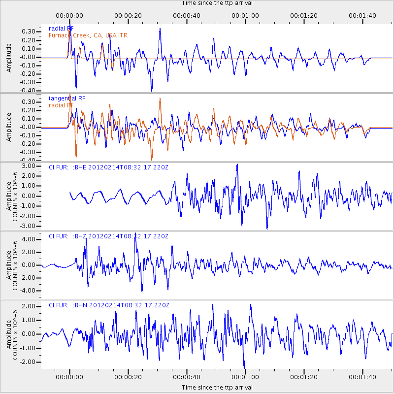
FUR Furnace Creek, CA, USA - Earthquake Result Viewer
*The percent match for this event was below the threshold and hence no stack was calculated.
| Earthquake location: |
Solomon Islands |
| Earthquake latitude/longitude: |
-10.4/161.1 |
| Earthquake time(UTC): |
2012/02/14 (045) 08:19:55 GMT |
| Earthquake Depth: |
51 km |
| Earthquake Magnitude: |
6.2 MB, 6.4 MW, 6.4 MW |
| Earthquake Catalog/Contributor: |
WHDF/NEIC |
|
| Network: |
CI Caltech Regional Seismic Network |
| Station: |
FUR Furnace Creek, CA, USA |
| Lat/Lon: |
36.47 N/116.86 W |
| Elevation: |
-37.0 m |
|
| Distance: |
89.8 deg |
| Az: |
52.971 deg |
| Baz: |
256.99 deg |
| Ray Param: |
$rayparam |
*The percent match for this event was below the threshold and hence was not used in the summary stack. |
|
| Radial Match: |
73.19652 % |
| Radial Bump: |
400 |
| Transverse Match: |
76.53918 % |
| Transverse Bump: |
400 |
| SOD ConfigId: |
439822 |
| Insert Time: |
2012-04-27 09:21:24.984 +0000 |
| GWidth: |
2.5 |
| Max Bumps: |
400 |
| Tol: |
0.001 |
|
Signal To Noise
| Channel | StoN | STA | LTA |
| CI:FUR: :BHZ:20120214T08:32:17.220Z | 4.134978 | 5.9331734E-7 | 1.4348743E-7 |
| CI:FUR: :BHN:20120214T08:32:17.220Z | 1.175916 | 4.1257107E-7 | 3.508508E-7 |
| CI:FUR: :BHE:20120214T08:32:17.220Z | 1.1435986 | 4.3978454E-7 | 3.8456201E-7 |
| Arrivals |
| Ps | |
| PpPs | |
| PsPs/PpSs | |


