You are here: Home > Network List > UW - Pacific Northwest Regional Seismic Network Stations List
> Station OMAK Colville Reservation, Omak, WA, USA > Earthquake Result Viewer
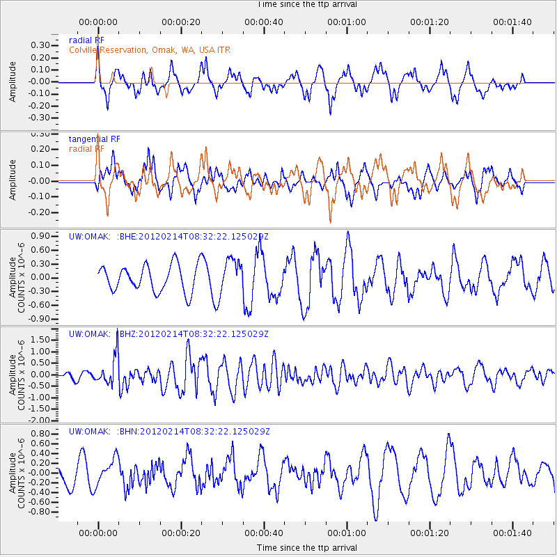
OMAK Colville Reservation, Omak, WA, USA - Earthquake Result Viewer
*The percent match for this event was below the threshold and hence no stack was calculated.
| Earthquake location: |
Solomon Islands |
| Earthquake latitude/longitude: |
-10.4/161.1 |
| Earthquake time(UTC): |
2012/02/14 (045) 08:19:55 GMT |
| Earthquake Depth: |
51 km |
| Earthquake Magnitude: |
6.2 MB, 6.4 MW, 6.4 MW |
| Earthquake Catalog/Contributor: |
WHDF/NEIC |
|
| Network: |
UW Pacific Northwest Regional Seismic Network |
| Station: |
OMAK Colville Reservation, Omak, WA, USA |
| Lat/Lon: |
48.36 N/119.33 W |
| Elevation: |
696 m |
|
| Distance: |
90.8 deg |
| Az: |
40.995 deg |
| Baz: |
255.386 deg |
| Ray Param: |
$rayparam |
*The percent match for this event was below the threshold and hence was not used in the summary stack. |
|
| Radial Match: |
64.26718 % |
| Radial Bump: |
376 |
| Transverse Match: |
53.076496 % |
| Transverse Bump: |
358 |
| SOD ConfigId: |
439822 |
| Insert Time: |
2012-04-27 09:26:39.862 +0000 |
| GWidth: |
2.5 |
| Max Bumps: |
400 |
| Tol: |
0.001 |
|
Signal To Noise
| Channel | StoN | STA | LTA |
| UW:OMAK: :BHZ:20120214T08:32:22.125029Z | 3.321082 | 6.483991E-7 | 1.952373E-7 |
| UW:OMAK: :BHN:20120214T08:32:22.125029Z | 1.6517444 | 2.7180977E-7 | 1.6455922E-7 |
| UW:OMAK: :BHE:20120214T08:32:22.125029Z | 1.2735437 | 3.6462842E-7 | 2.863101E-7 |
| Arrivals |
| Ps | |
| PpPs | |
| PsPs/PpSs | |


