You are here: Home > Network List > KN - Kyrgyz Seismic Telemetry Network Stations List
> Station TKM2 - > Earthquake Result Viewer
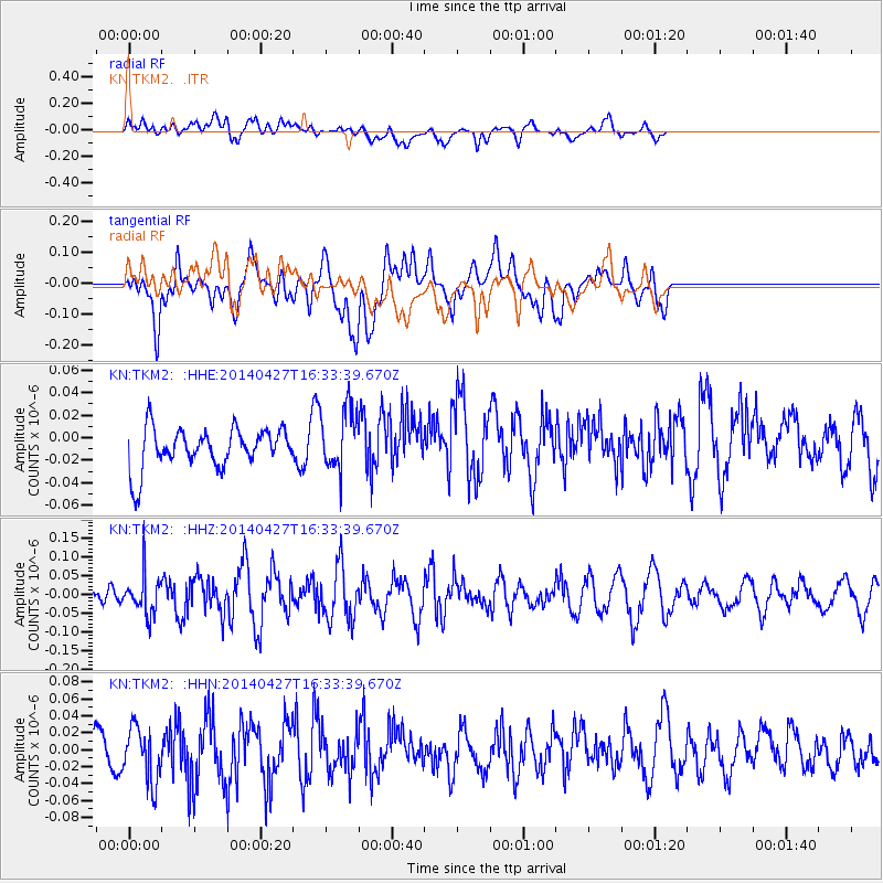
TKM2 - - Earthquake Result Viewer
*The percent match for this event was below the threshold and hence no stack was calculated.
| Earthquake location: |
Tanimbar Islands Reg., Indonesia |
| Earthquake latitude/longitude: |
-6.2/131.3 |
| Earthquake time(UTC): |
2014/04/27 (117) 16:23:05 GMT |
| Earthquake Depth: |
79 km |
| Earthquake Magnitude: |
5.0 MW |
| Earthquake Catalog/Contributor: |
ISC/ISC |
|
| Network: |
KN Kyrgyz Seismic Telemetry Network |
| Station: |
TKM2 - |
| Lat/Lon: |
42.92 N/75.60 E |
| Elevation: |
2020 m |
|
| Distance: |
70.2 deg |
| Az: |
319.843 deg |
| Baz: |
119.22 deg |
| Ray Param: |
$rayparam |
*The percent match for this event was below the threshold and hence was not used in the summary stack. |
|
| Radial Match: |
60.99355 % |
| Radial Bump: |
400 |
| Transverse Match: |
51.478924 % |
| Transverse Bump: |
400 |
| SOD ConfigId: |
3390531 |
| Insert Time: |
2019-04-11 15:13:03.056 +0000 |
| GWidth: |
2.5 |
| Max Bumps: |
400 |
| Tol: |
0.001 |
|
Signal To Noise
| Channel | StoN | STA | LTA |
| KN:TKM2: :HHZ:20140427T16:33:39.670Z | 1.1401678 | 5.1705417E-8 | 4.5348955E-8 |
| KN:TKM2: :HHN:20140427T16:33:39.670Z | 1.4444803 | 3.2120816E-8 | 2.2236936E-8 |
| KN:TKM2: :HHE:20140427T16:33:39.670Z | 1.6052349 | 2.8445562E-8 | 1.7720499E-8 |
| Arrivals |
| Ps | |
| PpPs | |
| PsPs/PpSs | |


