You are here: Home > Network List > TA - USArray Transportable Network (new EarthScope stations) Stations List
> Station X46A Booneville, MS, USA > Earthquake Result Viewer
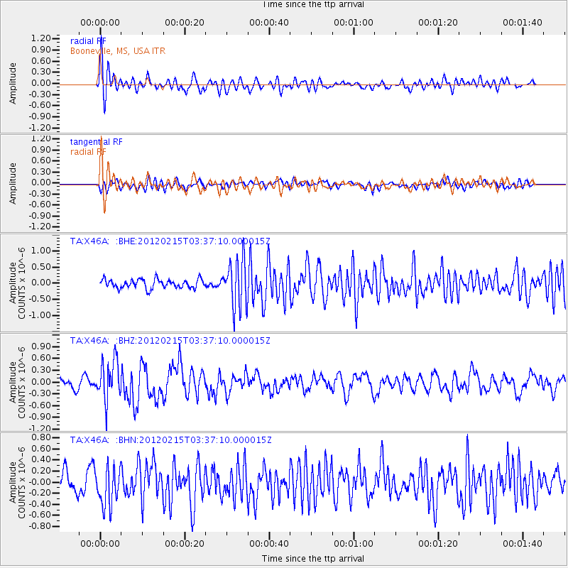
X46A Booneville, MS, USA - Earthquake Result Viewer
*The percent match for this event was below the threshold and hence no stack was calculated.
| Earthquake location: |
Off Coast Of Oregon |
| Earthquake latitude/longitude: |
43.6/-127.5 |
| Earthquake time(UTC): |
2012/02/15 (046) 03:31:20 GMT |
| Earthquake Depth: |
11 km |
| Earthquake Magnitude: |
5.5 MB, 5.5 MS, 5.8 MW, 5.8 MW |
| Earthquake Catalog/Contributor: |
WHDF/NEIC |
|
| Network: |
TA USArray Transportable Network (new EarthScope stations) |
| Station: |
X46A Booneville, MS, USA |
| Lat/Lon: |
34.56 N/88.58 W |
| Elevation: |
150 m |
|
| Distance: |
31.3 deg |
| Az: |
93.46 deg |
| Baz: |
298.568 deg |
| Ray Param: |
$rayparam |
*The percent match for this event was below the threshold and hence was not used in the summary stack. |
|
| Radial Match: |
77.82994 % |
| Radial Bump: |
400 |
| Transverse Match: |
61.05178 % |
| Transverse Bump: |
400 |
| SOD ConfigId: |
439822 |
| Insert Time: |
2012-04-27 09:44:31.259 +0000 |
| GWidth: |
2.5 |
| Max Bumps: |
400 |
| Tol: |
0.001 |
|
Signal To Noise
| Channel | StoN | STA | LTA |
| TA:X46A: :BHZ:20120215T03:37:10.000015Z | 3.8987594 | 5.1257143E-7 | 1.3147039E-7 |
| TA:X46A: :BHN:20120215T03:37:10.000015Z | 2.281711 | 3.6141864E-7 | 1.5839807E-7 |
| TA:X46A: :BHE:20120215T03:37:10.000015Z | 5.480686 | 7.4843945E-7 | 1.3655944E-7 |
| Arrivals |
| Ps | |
| PpPs | |
| PsPs/PpSs | |


