You are here: Home > Network List > UW - Pacific Northwest Regional Seismic Network Stations List
> Station HOOD Mt Hood Meadows, OR CREST BB SMO > Earthquake Result Viewer
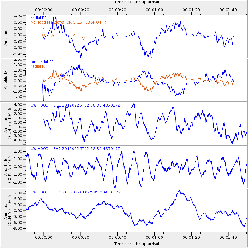
HOOD Mt Hood Meadows, OR CREST BB SMO - Earthquake Result Viewer
*The percent match for this event was below the threshold and hence no stack was calculated.
| Earthquake location: |
South Of Fiji Islands |
| Earthquake latitude/longitude: |
-24.5/-177.5 |
| Earthquake time(UTC): |
2012/02/26 (057) 02:46:21 GMT |
| Earthquake Depth: |
10 km |
| Earthquake Magnitude: |
5.5 MW, 5.1 MB |
| Earthquake Catalog/Contributor: |
WHDF/NEIC |
|
| Network: |
UW Pacific Northwest Regional Seismic Network |
| Station: |
HOOD Mt Hood Meadows, OR CREST BB SMO |
| Lat/Lon: |
45.32 N/121.65 W |
| Elevation: |
1520 m |
|
| Distance: |
86.0 deg |
| Az: |
35.819 deg |
| Baz: |
229.098 deg |
| Ray Param: |
$rayparam |
*The percent match for this event was below the threshold and hence was not used in the summary stack. |
|
| Radial Match: |
65.09828 % |
| Radial Bump: |
400 |
| Transverse Match: |
57.98634 % |
| Transverse Bump: |
400 |
| SOD ConfigId: |
440406 |
| Insert Time: |
2012-05-15 04:25:26.721 +0000 |
| GWidth: |
2.5 |
| Max Bumps: |
400 |
| Tol: |
0.001 |
|
Signal To Noise
| Channel | StoN | STA | LTA |
| UW:HOOD: :BHZ:20120226T02:58:30.485017Z | 0.6714341 | 1.0096329E-6 | 1.5036961E-6 |
| UW:HOOD: :BHN:20120226T02:58:30.485017Z | 1.7009555 | 6.0395264E-6 | 3.5506669E-6 |
| UW:HOOD: :BHE:20120226T02:58:30.485017Z | 0.6634484 | 1.3447632E-6 | 2.0269297E-6 |
| Arrivals |
| Ps | |
| PpPs | |
| PsPs/PpSs | |


