
TAM Tamanrasset, Algeria - Earthquake Result Viewer
| ||||||||||||||||||
| ||||||||||||||||||
| ||||||||||||||||||
|
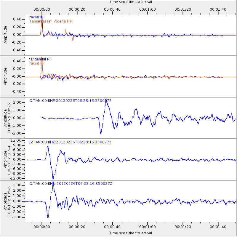
Signal To Noise
| Channel | StoN | STA | LTA |
| G:TAM:00:BHZ:20120226T06:28:16.350027Z | 48.681255 | 3.6306183E-6 | 7.457939E-8 |
| G:TAM:00:BHN:20120226T06:28:16.350027Z | 19.336336 | 1.2593093E-6 | 6.512658E-8 |
| G:TAM:00:BHE:20120226T06:28:16.350027Z | 15.762182 | 8.4681403E-7 | 5.3724413E-8 |
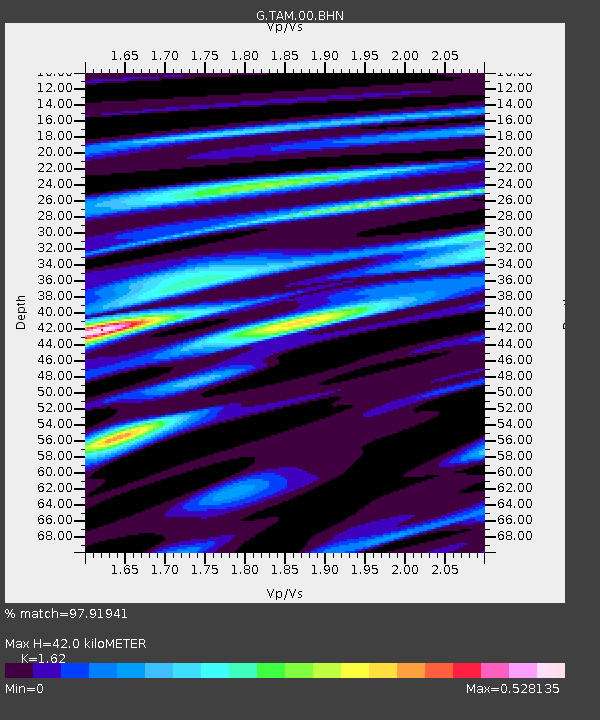
| Arrivals | |
| Ps | 4.1 SECOND |
| PpPs | 16 SECOND |
| PsPs/PpSs | 20 SECOND |

