ATD Arta Cave - Arta, Republic of Djibouti - Earthquake Result Viewer
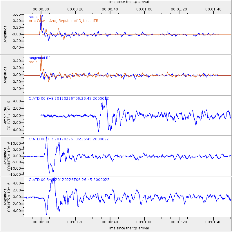
Earthquake location: Southwestern Siberia, Russia
Earthquake latitude/longitude: 51.7/96.0
Earthquake time(UTC): 2012/02/26 (057) 06:17:19 GMT
Earthquake Depth: 12 km
Earthquake Magnitude: 6.4 MB, 6.6 MS, 6.7 MW, 6.5 MW
Earthquake Catalog/Contributor: WHDF/NEIC
Network: G GEOSCOPE
Station: ATD Arta Cave - Arta, Republic of Djibouti
Lat/Lon: 11.53 N/42.85 E
Elevation: 610 m
Distance: 58.6 deg
Az: 246.769 deg
Baz: 35.69 deg
Ray Param: 0.06274509
Estimated Moho Depth: 14.5 km
Estimated Crust Vp/Vs: 1.62
Assumed Crust Vp: 6.375 km/s
Estimated Crust Vs: 3.947 km/s
Estimated Crust Poisson's Ratio: 0.19
Radial Match: 97.06898 %
Radial Bump: 400
Transverse Match: 86.76591 %
Transverse Bump: 400
SOD ConfigId: 440406
Insert Time: 2012-05-15 04:48:09.362 +0000
GWidth: 2.5
Max Bumps: 400
Tol: 0.001

Signal To Noise

ChannelStoNSTALTA
G:ATD:00:BHZ:20120226T06:26:45.200002Z46.898776.597999E-61.4068597E-7
G:ATD:00:BHN:20120226T06:26:45.200002Z11.5543951.9457523E-61.6839932E-7
G:ATD:00:BHE:20120226T06:26:45.200002Z9.5295011.6559399E-61.7376983E-7
Arrivals
Ps1.5 SECOND
PpPs5.6 SECOND
PsPs/PpSs7.1 SECOND