
EIL GEOFON Station Eilat, Israel - Earthquake Result Viewer
| ||||||||||||||||||
| ||||||||||||||||||
| ||||||||||||||||||
|

Signal To Noise
| Channel | StoN | STA | LTA |
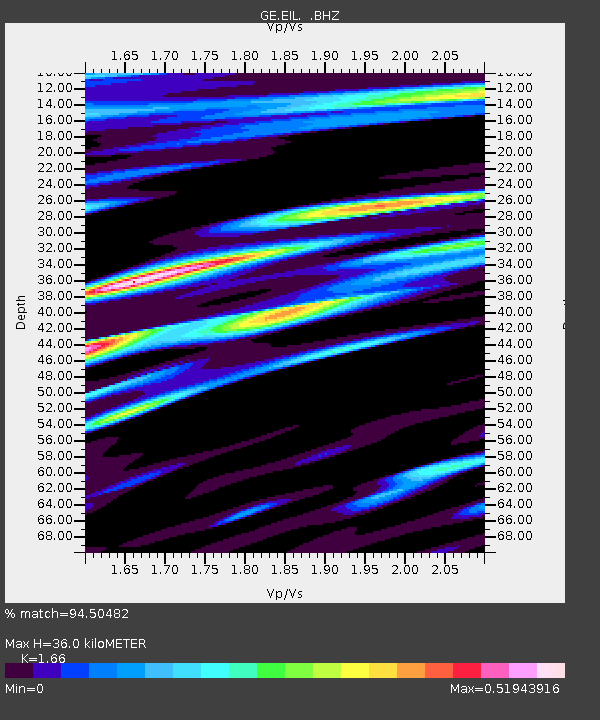
| GE:EIL: :BHZ:20120226T06:25:39.99999Z | 79.43304 | 9.736753E-6 | 1.2257813E-7 |
| GE:EIL: :BHN:20120226T06:25:39.99999Z | 34.709557 | 3.1810318E-6 | 9.1647145E-8 |
| GE:EIL: :BHE:20120226T06:25:39.99999Z | 15.422051 | 2.2763488E-6 | 1.476035E-7 |
| Arrivals | |
| Ps | 3.9 SECOND |
| PpPs | 14 SECOND |
| PsPs/PpSs | 18 SECOND |

