N34A Lincoln, NE, USA - Earthquake Result Viewer
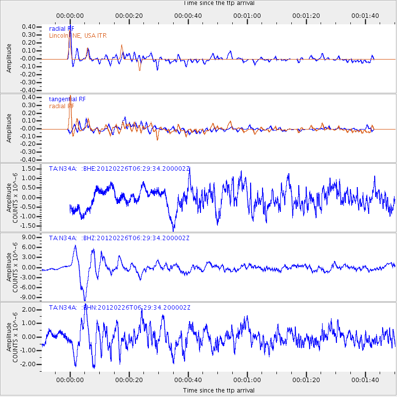
Earthquake location: Southwestern Siberia, Russia
Earthquake latitude/longitude: 51.7/96.0
Earthquake time(UTC): 2012/02/26 (057) 06:17:19 GMT
Earthquake Depth: 12 km
Earthquake Magnitude: 6.4 MB, 6.6 MS, 6.7 MW, 6.5 MW
Earthquake Catalog/Contributor: WHDF/NEIC
Network: TA USArray Transportable Network (new EarthScope stations)
Station: N34A Lincoln, NE, USA
Lat/Lon: 40.84 N/96.50 W
Elevation: 401 m
Distance: 87.2 deg
Az: 9.457 deg
Baz: 352.256 deg
Ray Param: 0.04349793
Estimated Moho Depth: 58.0 km
Estimated Crust Vp/Vs: 1.69
Assumed Crust Vp: 6.498 km/s
Estimated Crust Vs: 3.845 km/s
Estimated Crust Poisson's Ratio: 0.23
Radial Match: 84.577515 %
Radial Bump: 400
Transverse Match: 64.112404 %
Transverse Bump: 400
SOD ConfigId: 440406
Insert Time: 2012-05-15 05:03:37.585 +0000
GWidth: 2.5
Max Bumps: 400
Tol: 0.001

Signal To Noise

ChannelStoNSTALTA
TA:N34A: :BHZ:20120226T06:29:34.200002Z7.69407224.341155E-65.642207E-7
TA:N34A: :BHN:20120226T06:29:34.200002Z2.29509629.819457E-74.278451E-7
TA:N34A: :BHE:20120226T06:29:34.200002Z1.32775776.35276E-74.7845776E-7
Arrivals
Ps6.3 SECOND
PpPs23 SECOND
PsPs/PpSs30 SECOND