E31A Nome, ND, USA - Earthquake Result Viewer
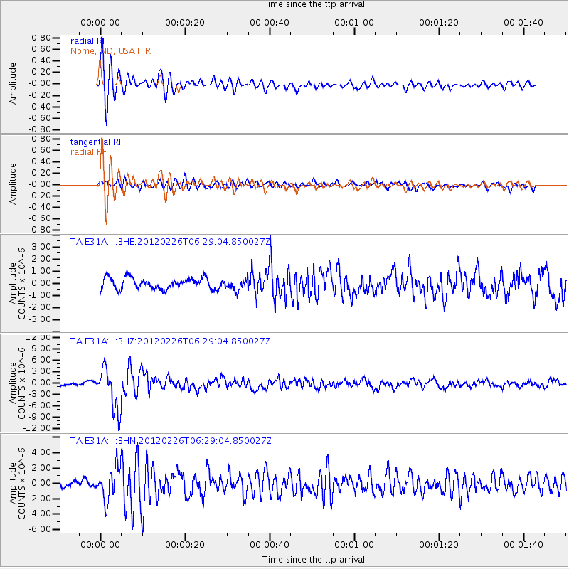
Earthquake location: Southwestern Siberia, Russia
Earthquake latitude/longitude: 51.7/96.0
Earthquake time(UTC): 2012/02/26 (057) 06:17:19 GMT
Earthquake Depth: 12 km
Earthquake Magnitude: 6.4 MB, 6.6 MS, 6.7 MW, 6.5 MW
Earthquake Catalog/Contributor: WHDF/NEIC
Network: TA USArray Transportable Network (new EarthScope stations)
Station: E31A Nome, ND, USA
Lat/Lon: 46.56 N/97.89 W
Elevation: 427 m
Distance: 81.4 deg
Az: 9.637 deg
Baz: 351.318 deg
Ray Param: 0.04761851
Estimated Moho Depth: 14.25 km
Estimated Crust Vp/Vs: 2.09
Assumed Crust Vp: 6.498 km/s
Estimated Crust Vs: 3.113 km/s
Estimated Crust Poisson's Ratio: 0.35
Radial Match: 88.9235 %
Radial Bump: 400
Transverse Match: 78.049736 %
Transverse Bump: 400
SOD ConfigId: 440406
Insert Time: 2012-05-15 05:08:29.695 +0000
GWidth: 2.5
Max Bumps: 400
Tol: 0.001

Signal To Noise

ChannelStoNSTALTA
TA:E31A: :BHZ:20120226T06:29:04.850027Z11.8289975.613094E-64.7451988E-7
TA:E31A: :BHN:20120226T06:29:04.850027Z4.94560962.1174803E-64.2815356E-7
TA:E31A: :BHE:20120226T06:29:04.850027Z1.1044794.778315E-74.326307E-7
Arrivals
Ps2.4 SECOND
PpPs6.6 SECOND
PsPs/PpSs9.1 SECOND