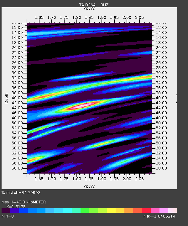
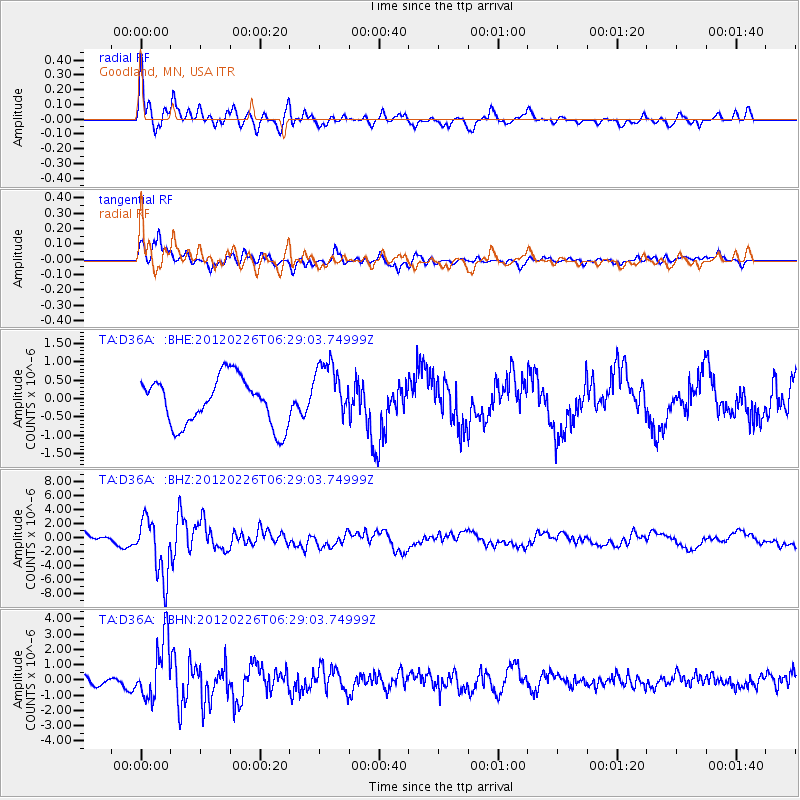
D36A Goodland, MN, USA - Earthquake Result Viewer

Earthquake location: Southwestern Siberia, Russia
Earthquake latitude/longitude: 51.7/96.0
Earthquake time(UTC): 2012/02/26 (057) 06:17:19 GMT
Earthquake Depth: 12 km
Earthquake Magnitude: 6.4 MB, 6.6 MS, 6.7 MW, 6.5 MW
Earthquake Catalog/Contributor: WHDF/NEIC
Network: TA USArray Transportable Network (new EarthScope stations)
Station: D36A Goodland, MN, USA
Lat/Lon: 47.18 N/93.16 W
Elevation: 434 m
Distance: 81.2 deg
Az: 6.306 deg
Baz: 354.25 deg
Ray Param: 0.047763355
Estimated Moho Depth: 43.0 km
Estimated Crust Vp/Vs: 1.82
Assumed Crust Vp: 6.571 km/s
Estimated Crust Vs: 3.615 km/s
Estimated Crust Poisson's Ratio: 0.28
Radial Match: 84.70903 %
Radial Bump: 400
Transverse Match: 70.82916 %
Transverse Bump: 400
SOD ConfigId: 440406
Insert Time: 2012-05-15 05:10:50.156 +0000
GWidth: 2.5
Max Bumps: 400
Tol: 0.001

Signal To Noise

ChannelStoNSTALTA
TA:D36A: :BHZ:20120226T06:29:03.74999Z6.36188274.1514295E-66.525473E-7
TA:D36A: :BHN:20120226T06:29:03.74999Z6.94107151.9438878E-62.8005584E-7
TA:D36A: :BHE:20120226T06:29:03.74999Z1.27357918.177418E-76.4208166E-7
Arrivals
Ps5.5 SECOND
PpPs18 SECOND
PsPs/PpSs23 SECOND