
G32A Webster, SD, USA - Earthquake Result Viewer
| ||||||||||||||||||
| ||||||||||||||||||
| ||||||||||||||||||
|
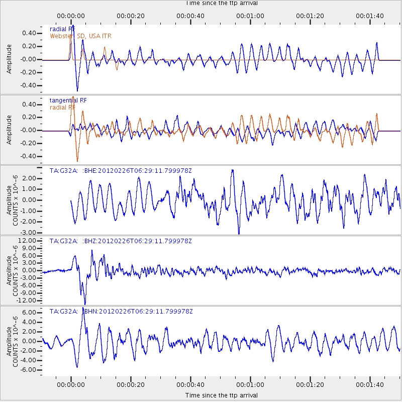
Signal To Noise
| Channel | StoN | STA | LTA |
| TA:G32A: :BHZ:20120226T06:29:11.799978Z | 11.673888 | 5.6490394E-6 | 4.839039E-7 |
| TA:G32A: :BHN:20120226T06:29:11.799978Z | 4.728679 | 3.3964568E-6 | 7.182676E-7 |
| TA:G32A: :BHE:20120226T06:29:11.799978Z | 0.67274505 | 7.256681E-7 | 1.0786673E-6 |
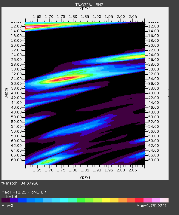
| Arrivals | |
| Ps | 1.2 SECOND |
| PpPs | 4.7 SECOND |
| PsPs/PpSs | 5.9 SECOND |

