F31A Hecla, SD, USA - Earthquake Result Viewer
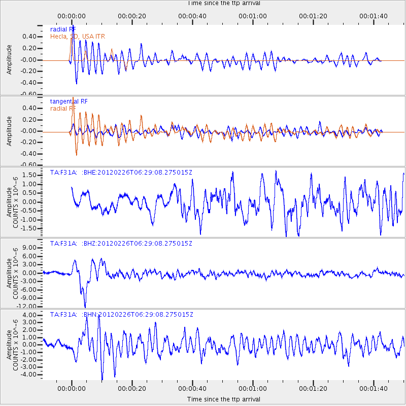
Earthquake location: Southwestern Siberia, Russia
Earthquake latitude/longitude: 51.7/96.0
Earthquake time(UTC): 2012/02/26 (057) 06:17:19 GMT
Earthquake Depth: 12 km
Earthquake Magnitude: 6.4 MB, 6.6 MS, 6.7 MW, 6.5 MW
Earthquake Catalog/Contributor: WHDF/NEIC
Network: TA USArray Transportable Network (new EarthScope stations)
Station: F31A Hecla, SD, USA
Lat/Lon: 45.86 N/98.25 W
Elevation: 412 m
Distance: 82.0 deg
Az: 9.998 deg
Baz: 351.107 deg
Ray Param: 0.047160495
Estimated Moho Depth: 28.5 km
Estimated Crust Vp/Vs: 2.09
Assumed Crust Vp: 6.53 km/s
Estimated Crust Vs: 3.125 km/s
Estimated Crust Poisson's Ratio: 0.35
Radial Match: 83.64965 %
Radial Bump: 400
Transverse Match: 78.10515 %
Transverse Bump: 400
SOD ConfigId: 440406
Insert Time: 2012-05-15 05:11:15.722 +0000
GWidth: 2.5
Max Bumps: 400
Tol: 0.001

Signal To Noise

ChannelStoNSTALTA
TA:F31A: :BHZ:20120226T06:29:08.275015Z8.7961615.0631625E-65.756105E-7
TA:F31A: :BHN:20120226T06:29:08.275015Z2.93418151.3518754E-64.6073342E-7
TA:F31A: :BHE:20120226T06:29:08.275015Z1.39469094.941198E-73.5428624E-7
Arrivals
Ps4.9 SECOND
PpPs13 SECOND
PsPs/PpSs18 SECOND