G35A Watkins, MN, USA - Earthquake Result Viewer
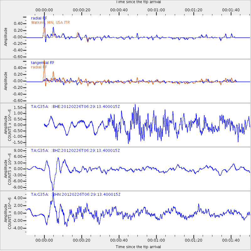
Earthquake location: Southwestern Siberia, Russia
Earthquake latitude/longitude: 51.7/96.0
Earthquake time(UTC): 2012/02/26 (057) 06:17:19 GMT
Earthquake Depth: 12 km
Earthquake Magnitude: 6.4 MB, 6.6 MS, 6.7 MW, 6.5 MW
Earthquake Catalog/Contributor: WHDF/NEIC
Network: TA USArray Transportable Network (new EarthScope stations)
Station: G35A Watkins, MN, USA
Lat/Lon: 45.22 N/94.49 W
Elevation: 361 m
Distance: 83.0 deg
Az: 7.439 deg
Baz: 353.455 deg
Ray Param: 0.0464732
Estimated Moho Depth: 47.0 km
Estimated Crust Vp/Vs: 1.67
Assumed Crust Vp: 6.571 km/s
Estimated Crust Vs: 3.929 km/s
Estimated Crust Poisson's Ratio: 0.22
Radial Match: 81.464005 %
Radial Bump: 400
Transverse Match: 76.149254 %
Transverse Bump: 400
SOD ConfigId: 440406
Insert Time: 2012-05-15 05:11:53.794 +0000
GWidth: 2.5
Max Bumps: 400
Tol: 0.001

Signal To Noise

ChannelStoNSTALTA
TA:G35A: :BHZ:20120226T06:29:13.400015Z4.96014364.526571E-69.1258875E-7
TA:G35A: :BHN:20120226T06:29:13.400015Z3.53503662.3884847E-66.7566054E-7
TA:G35A: :BHE:20120226T06:29:13.400015Z0.72908322.3023779E-73.1579083E-7
Arrivals
Ps5.0 SECOND
PpPs19 SECOND
PsPs/PpSs24 SECOND