
S39A Bolivar, MO, USA - Earthquake Result Viewer
| ||||||||||||||||||
| ||||||||||||||||||
| ||||||||||||||||||
|
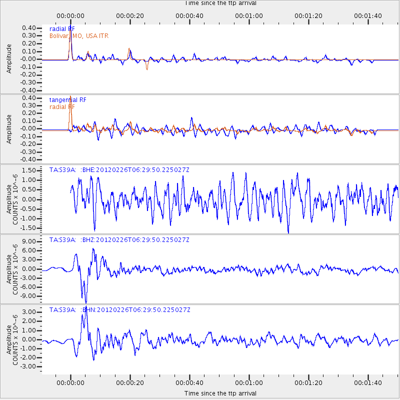
Signal To Noise
| Channel | StoN | STA | LTA |
| TA:S39A: :BHZ:20120226T06:29:50.225027Z | 6.8796806 | 3.7378788E-6 | 5.4332156E-7 |
| TA:S39A: :BHN:20120226T06:29:50.225027Z | 4.5077887 | 1.2154894E-6 | 2.6964204E-7 |
| TA:S39A: :BHE:20120226T06:29:50.225027Z | 1.1719533 | 6.267626E-7 | 5.348017E-7 |
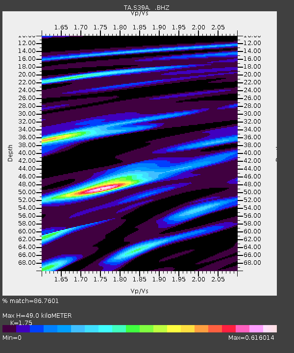
| Arrivals | |
| Ps | 5.8 SECOND |
| PpPs | 20 SECOND |
| PsPs/PpSs | 26 SECOND |

