V39A Pettigrew, AR, USA - Earthquake Result Viewer
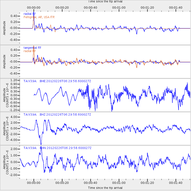
Earthquake location: Southwestern Siberia, Russia
Earthquake latitude/longitude: 51.7/96.0
Earthquake time(UTC): 2012/02/26 (057) 06:17:19 GMT
Earthquake Depth: 12 km
Earthquake Magnitude: 6.4 MB, 6.6 MS, 6.7 MW, 6.5 MW
Earthquake Catalog/Contributor: WHDF/NEIC
Network: TA USArray Transportable Network (new EarthScope stations)
Station: V39A Pettigrew, AR, USA
Lat/Lon: 35.84 N/93.64 W
Elevation: 744 m
Distance: 92.4 deg
Az: 7.824 deg
Baz: 354.016 deg
Ray Param: 0.041461162
Estimated Moho Depth: 13.25 km
Estimated Crust Vp/Vs: 1.84
Assumed Crust Vp: 6.498 km/s
Estimated Crust Vs: 3.541 km/s
Estimated Crust Poisson's Ratio: 0.29
Radial Match: 84.86472 %
Radial Bump: 400
Transverse Match: 75.57826 %
Transverse Bump: 400
SOD ConfigId: 440406
Insert Time: 2012-05-15 05:17:10.751 +0000
GWidth: 2.5
Max Bumps: 400
Tol: 0.001

Signal To Noise

ChannelStoNSTALTA
TA:V39A: :BHZ:20120226T06:29:58.600027Z5.43191772.002311E-63.6861957E-7
TA:V39A: :BHN:20120226T06:29:58.600027Z1.77775927.142494E-74.0176948E-7
TA:V39A: :BHE:20120226T06:29:58.600027Z0.91201463.0520988E-73.346546E-7
Arrivals
Ps1.7 SECOND
PpPs5.7 SECOND
PsPs/PpSs7.4 SECOND