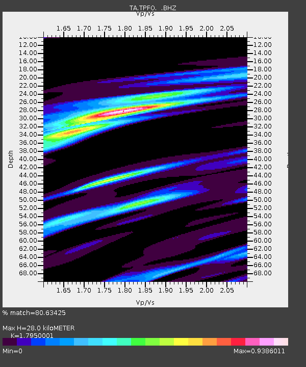
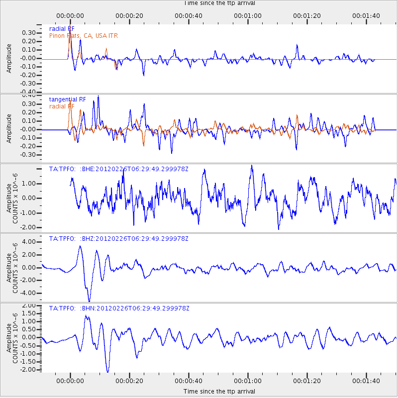
TPFO Pinon Flats, CA, USA - Earthquake Result Viewer

Earthquake location: Southwestern Siberia, Russia
Earthquake latitude/longitude: 51.7/96.0
Earthquake time(UTC): 2012/02/26 (057) 06:17:19 GMT
Earthquake Depth: 12 km
Earthquake Magnitude: 6.4 MB, 6.6 MS, 6.7 MW, 6.5 MW
Earthquake Catalog/Contributor: WHDF/NEIC
Network: TA USArray Transportable Network (new EarthScope stations)
Station: TPFO Pinon Flats, CA, USA
Lat/Lon: 33.61 N/116.45 W
Elevation: 1275 m
Distance: 90.4 deg
Az: 26.6 deg
Baz: 340.498 deg
Ray Param: 0.0416758
Estimated Moho Depth: 28.0 km
Estimated Crust Vp/Vs: 1.80
Assumed Crust Vp: 6.264 km/s
Estimated Crust Vs: 3.489 km/s
Estimated Crust Poisson's Ratio: 0.27
Radial Match: 80.63425 %
Radial Bump: 400
Transverse Match: 67.02776 %
Transverse Bump: 400
SOD ConfigId: 440406
Insert Time: 2012-05-15 05:20:24.902 +0000
GWidth: 2.5
Max Bumps: 400
Tol: 0.001

Signal To Noise

ChannelStoNSTALTA
TA:TPFO: :BHZ:20120226T06:29:49.299978Z4.19353531.6287195E-63.8838814E-7
TA:TPFO: :BHN:20120226T06:29:49.299978Z1.31629233.737359E-72.839308E-7
TA:TPFO: :BHE:20120226T06:29:49.299978Z0.95314846.317003E-76.6275123E-7
Arrivals
Ps3.6 SECOND
PpPs12 SECOND
PsPs/PpSs16 SECOND